View All Articles

Your Local Weather Radar | Live Doppler Radar

Weather Radar  

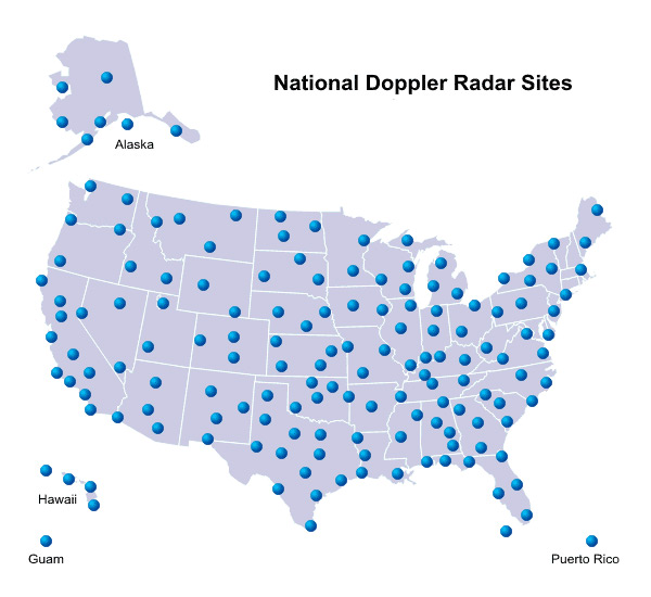
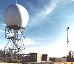
The National Weather Service (NWS) operates a network of 154 Dopplar Radar sites across the United States, commonly called NEXRAD for Next-Generation Radar. These weather radars provide a view inside a storm where its behavior is observed to determine the development of threatening weather.

Threatening weather that can be observed includes tornados, hail storms, thunderstorms, flooding, and straight line wind such as derechos. For any of these events NWS forecasters will issue a tornado warning, severe thunderstorm warning, or flood warning. Of course there is also a general purpuse use to weather radars such as determining the approach or exit of rain or snow from an area. Weather radar coverage reaches every major city and you can view your local radar in real-time by clicking on the closest radar to your location below…..

Weather Radar Sites Across United States

This entry was posted in Weather Articles and tagged , , , . Bookmark the permalink.

Leave a Reply

Read More

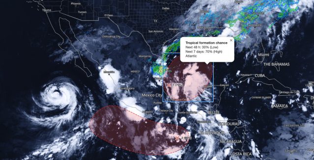
Gulf tropical development map showing NHC 70% seven-day formation chance for a southwestern Gulf disturbance on October 5, 2026

Gulf Tropical Development: NHC Raises Formation Odds to 70% for Southwestern Gulf Disturbance

NHC tropical formation chances as of 8 AM EDT Monday, October 5, 2026: 70% over seven days in the southwestern Gulf (1) and 90% south of southern Mexico in the eastern Pacific (2). Map: iAlert.com Gulf…

Read More

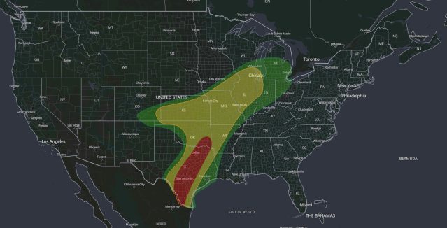
Moderate Risk flash flood map: WPC Day 1 Excessive Rainfall Outlook for October 1, 2026, with a Level 3 of 4 Moderate Risk from South Texas through San Antonio, Austin and Dallas-Fort Worth to southeast Oklahoma, and a Slight Risk from Texas to Wisconsin and Indiana

Moderate Risk Flash Flood: Dangerous Rain for Texas, Oct 1

iAlert weather analysis view of the WPC Day 1 Excessive Rainfall Outlook valid 7:00 am CDT Thursday, October 1, 2026, to 7:00 am CDT Friday, October 2. The innermost area is the Level 3 of 4…

Read More

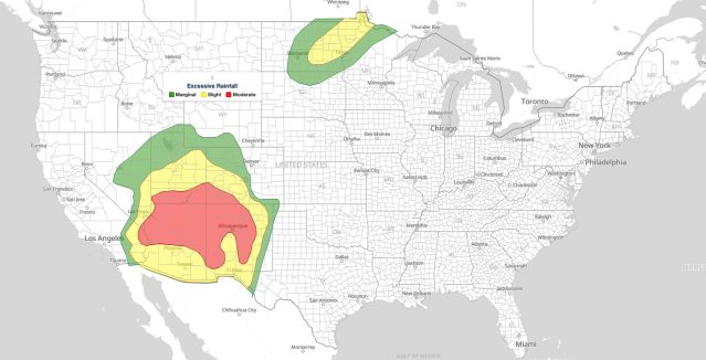
Moderate Risk flash flooding map: WPC Day 1 Excessive Rainfall Outlook for September 28, 2026, with a level 3 of 4 Moderate Risk over the Four Corners from the Colorado River to Albuquerque and Slight Risk over eastern North Dakota and northwest Minnesota

Moderate Risk Flash Flooding in the Southwest: WPC Level 3 of 4 Excessive Rainfall Outlook for September 28, 2026

WPC Day 1 Excessive Rainfall Outlook, 16Z update issued 11:33 am EDT Monday, September 28, 2026. Red marks the Moderate Risk flash flooding area (level 3 of 4) across the Four Corners, yellow the Slight Risk…

Read More

Leave a Reply