Upper Ohio Valley Severe Weather: Enhanced Risk July 21, 2026
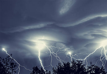
Upper Ohio Valley severe weather threatens damaging wind gusts, large hail, and tornadoes July 21, 2026. SPC issues an Enhanced Risk for the Mid-Atlantic.

Upper Midwest Severe Thunderstorms: Enhanced Risk July 20, 2026
Upper Midwest severe thunderstorms carry an Enhanced Risk July 20, 2026. Damaging winds, large hail, and tornadoes possible from Minnesota to the Great Lakes.

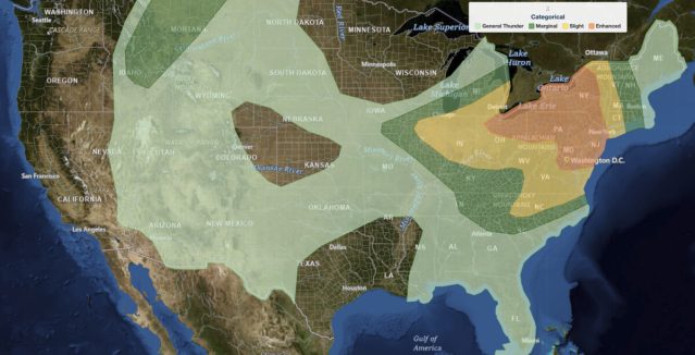
Southeast Severe Thunderstorms and Dakotas Hail Threat: SPC Outlook for July 19, 2026
Southeast severe thunderstorms threaten damaging winds from north Georgia to southern Virginia on July 19, 2026, while the Dakotas face hail and wind risks.
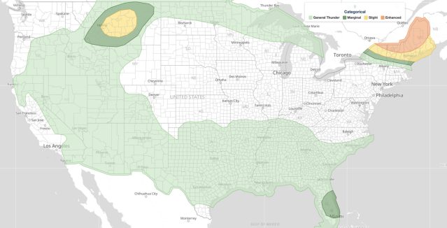
Northeast Severe Thunderstorms: Enhanced Risk July 18, 2026
Northeast severe thunderstorms threaten widespread damaging winds, hail, and tornadoes from the Ohio Valley to New England on July 18, 2026.
Northeast Severe Thunderstorms Threaten Northern New York and New England on July 14
Northeast severe thunderstorms bring damaging wind gusts above 70 mph, large hail, and tornado risk to northern New York and New England on July 14, 2026.

Mid-Atlantic Severe Thunderstorms Put Washington DC in Highest Wind Risk for July 4 Fireworks
Mid-Atlantic severe thunderstorms carry an Enhanced Risk on July 4, 2026, with damaging wind gusts, large hail up to 15% probability, and storms from WV to NJ.

Northern Plains Severe Thunderstorms: Enhanced Risk Issued for July 2, 2026
Northern Plains severe thunderstorms carry an Enhanced Risk on July 2, 2026. Large hail, 75+ mph wind gusts, and tornadoes are possible across the Dakotas and Upper Midwest.
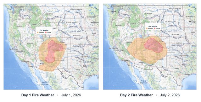
Critical Fire Weather Outlook: SPC Flags Dangerous Conditions June 30 Through July 2, 2026
Critical fire weather conditions flagged by SPC for June 30 through July 2, 2026. Strong winds, low humidity, and dry fuels combine to raise wildfire risk.

Midwest Severe Thunderstorms: Enhanced Risk Brings 80 MPH Gusts, Large Hail, and Tornadoes on July 1
Midwest severe thunderstorms threaten the Upper Great Lakes July 1 with wind gusts near 80 mph, very large hail, and tornadoes. Here's what to expect.