
Thunderstorms are among the most powerful weather events on Earth. They can bring much needed rainfall, yet they also produce dangerous hazards such as lightning, hail, flash flooding, and tornadoes. Understanding how storms form, how they evolve, and how meteorologists detect and forecast them helps communities prepare and stay safe.
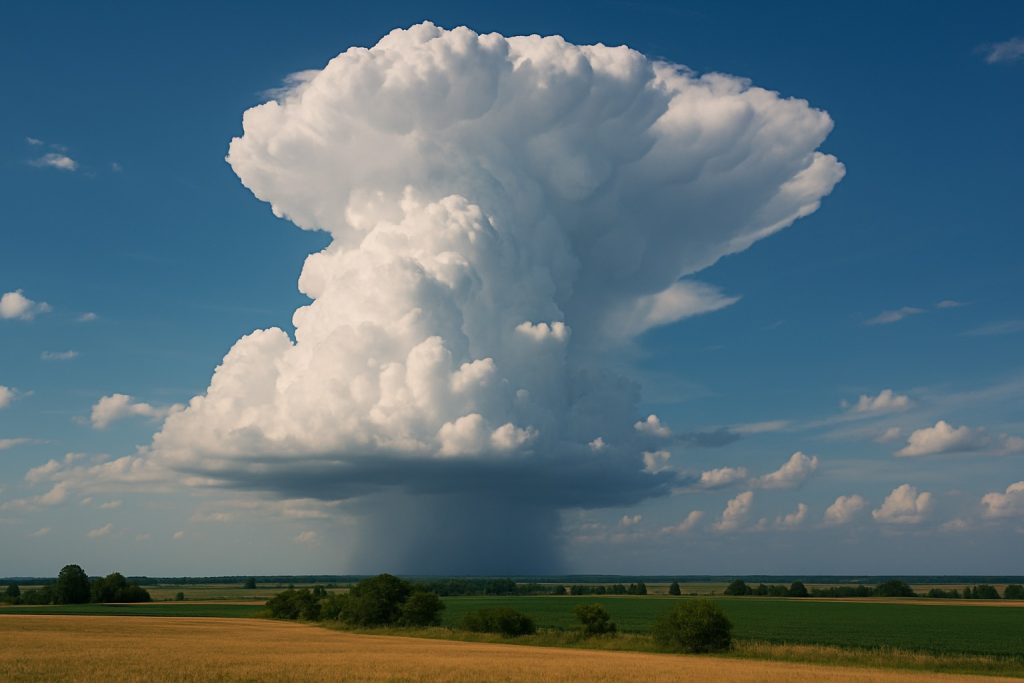
Developing Cumulonimbus Cloud
What is a Thunderstorm
A thunderstorm is a rain shower accompanied by thunder and lightning. Because thunder is the sound produced by lightning, every thunderstorm has lightning.- Worldwide activity: About 16 million thunderstorms occur each year with roughly 2,000 ongoing at any moment.
- United States activity: Around 100,000 thunderstorms occur annually. About 10 percent reach severe levels.
Ingredients for Thunderstorm Formation
Three basic ingredients are required for a thunderstorm to form:- Moisture to support cloud and precipitation formation.
- Unstable rising air that continues upward when lifted.
- A lifting mechanism such as fronts, outflow boundaries, mountains, or sea breezes.
Life Cycle of a Thunderstorm
Stage 1: Developing stage
- Towering cumulus clouds form due to strong updrafts.
- Lightning may occur, but little to no rain reaches the ground.
Stage 2: Mature stage
- Updrafts and downdrafts coexist.
- Heavy rain, hail, frequent lightning, strong winds, and possible tornadoes.
- This is typically the most intense phase.
Stage 3: Dissipating stage
- Downdrafts dominate and cut off warm moist inflow.
- Rainfall tapers, but lightning can remain hazardous.
Thunderstorm Types
Single cell thunderstorms
Short lived storms that often form on warm afternoons. Sometimes called popcorn convection. They typically last less than an hour and can produce brief heavy rain and lightning.Multi cell thunderstorms
Groups of storm cells that develop along a gust front. Systems can last for hours and may produce hail, strong winds, brief tornadoes, and flooding.Squall lines
Lines of thunderstorms capable of widespread straight line wind and heavy rain. They can extend hundreds of miles yet are generally less tornado prone than supercells.Supercells
Highly organized storms with a rotating updraft called a mesocyclone. They can persist for hours and are capable of producing the largest hail, strongest winds, and violent tornadoes.Thunderstorm Hazards
- Flash flooding: A leading cause of thunderstorm related fatalities.
- Lightning: Can strike miles from the storm core and cause fires, injuries, and fatalities.
- Hail: Can reach softball size and damage vehicles, roofs, crops, and livestock.
- Straight line winds: Can exceed 120 mph and topple trees, power lines, and structures.
- Tornadoes: The most destructive hazard with winds that can exceed 300 mph.
Detecting and Forecasting
- Satellites: Monitor cloud development, motion, and cloud top temperatures to infer storm growth.
- Radars: Detect precipitation, hail signatures, and wind patterns. Doppler technology can reveal rotation.
- Forecast models: Numerical models simulate atmospheric evolution to assess thunderstorm potential.
- Ensemble forecasting: Multiple model runs capture uncertainty and provide a range of outcomes.
Watches and Warnings
- Severe Thunderstorm Watch: Conditions are favorable for severe storms. Stay alert and monitor updates.
- Severe Thunderstorm Warning: Severe weather is occurring or imminent based on radar or spotter reports. Take immediate action and seek safe shelter.


