
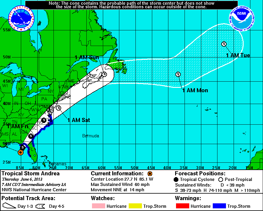
Tropical Storm Andrea Bears down on Florida
8:30 A.M. Thursday June 6, 2013: The first Tropical Storm of the 2013 Atlantic hurricane season is “Tropical Storm Andrea” which quickly developed in the Gulf of Mexico on Wednesday. Andrea is forecast to bring heavy rain, flooding, and a strong potential of severe thunderstorms and tornadoes for Florida up through southeastern seaboard over the next couple days.
As of 8:30 a.m. ET, Tropical Storm Andrea had winds of 60 mph and was moving north-northeast at 15mph. Center of the storm was located approximately 150 miles west of Tampa Florida. The forecast is for Andrea is to make landfall near Tampa Thursday afternoon bringing with it 2-4 inches of rain over much of the Florida Peninsula, tropical storm force winds near 60 MPH, and 1-2 ft storm surge Tampa bay south and up to 5 ft storm surge Tampa Bay northward to Apalachicola.
Monitor iAlert.com Real-time Alert Map for the latest warnings on Tropical Storm Andrea.
This entry was posted in Weather Articles and tagged tropical storm, tropical storm advisory, tropical storm andrea, tropical storm warning, tropical storm watch. Bookmark the permalink.
Read More
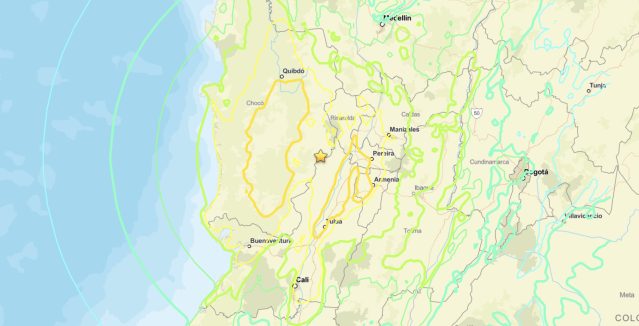
Colombia Earthquake M7.4 Strikes Near San José del Palmar
Image 1: USGS ShakeMap intensity contours for the Colombia earthquake M7.4 of August 10, 2026. The star marks the epicenter 5 km east of San José del Palmar. Source: U.S. Geological Survey. Colombia earthquake M7.4 struck…
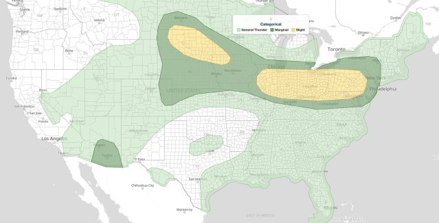
Midwest Severe Thunderstorms: Slight Risk of Damaging Wind and Hail From Illinois to Pennsylvania, August 10, 2026
Midwest severe thunderstorms are the main weather story on Monday, August 10, 2026. The NOAA Storm Prediction Center issued its Day 1 Convective Outlook at 05:25 UTC placing a long corridor from northern Illinois through Indiana,…
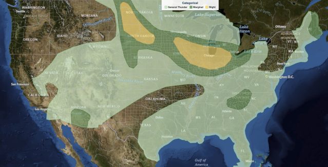
Midwest Severe Thunderstorms: Slight Risk of Damaging Winds From Eastern Iowa to Toledo, August 9, 2026
Midwest severe thunderstorms are today's main weather story, August 9, 2026, with the NOAA Storm Prediction Center drawing a Slight Risk across a corridor that runs from southeast Minnesota and eastern Iowa east through northern Illinois…