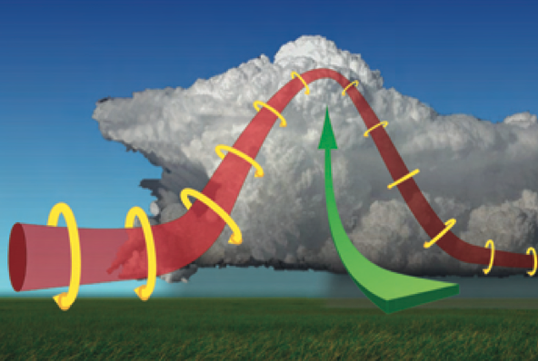
How Tornadoes Form
The formation of a tornado can be broken down to three stages: 1) low level horizontal spin,…

Understanding Hail
Hail, Showery precipitation in the form of irregular pellets or balls of ice more than 5 mm…
Severe Weather Preparedness
Tornadoes, floods, thunderstorm winds, hail, lightning, heat, wildfires, rip currents and tsunamis - spring is three months…


Search Local Weather Conditions

2023 Atlantic Hurricane Names | 2023 Atlantic Tropical Cyclone Reports
Hurricanes are named alphabetically from a predetermined list beginning the letter “A” through “W”, excluding names that begin with “Q” or “U.” A storm is first named by the National Hurricane Center when the system becomes a tropical storm…

iAlert Services’ WxData.com Joins API3 Alliance as Founding Member
As a leading weather data provider, it will always be our responsibility to help strengthen and develop the API economy as much as we can. That is why iAlert Services (iAlert.com) is proud to announce that…
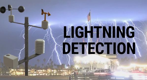
Lightning Strike: What are the Capabilities of Lightning Detection Systems
Two decades before the American Revolutionary War, noted inventor and scientist Benjamin Franklin had a strong curiosity when it came to the incredibly destructive force of lightning. Franklin is known for inventing one of the first…

What is a Nor’easter?
A Nor’easter is a storm along the East Coast of North America, so called because the winds over the coastal area are typically from the northeast. These storms usually develop in the latitudes between Georgia and…
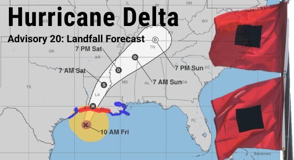
Hurricane Delta 11:00 am October 9, 2020 Advisory 20 Update, Landfall Forecast
Advisory 20 for Hurricane Delta updated at 11:00 am EDT Friday October 9, 2020: As of 11:00 am EDT Hurricane Delta remains a major category 3 hurricane with sustained winds of 115 MPH (185 KMH) and…

Hurricane Delta 5:00 pm October 8, 2020 Advisory 17 Update
Advisory 17 for Hurricane Delta updated at 5:00 pm EDT Thursday October 8, 2020: As of 5:00 pm EDT Hurricane Delta was a major category 3 hurricane with sustained winds of 115 MPH (185 KMH) and…
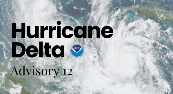
Hurricane Delta 11:00 am October 7, 2020 Advisory 12 Update
Advisory 12 for Hurricane Delta updated at 11:00 am EDT Wednesday October 7, 2020: As of 11:00 am EDT Hurricane Delta was strong category 2 hurricane with sustained winds of 105 MPH and was located 65…

2022 Atlantic Hurricane Names | 2022 Atlantic Tropical Cyclone Reports
Hurricanes are named alphabetically from a predetermined list beginning the letter “A” through “W”, excluding names that begin with “Q” or “U.” A storm is first named by the National Hurricane Center when the system becomes a tropical storm…
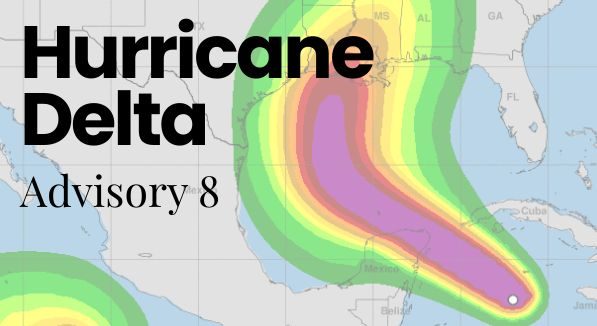
Hurricane Delta Rapidly Intensifies to Category 4 and Forecast to Hit Gulf Coast Late This Week
Advisory 8 for Hurricane Delta updated 11:00 AM EDT Tuesday October 6, 2020: Extremely dangerous storm surge and hurricane conditions are expected within portions of the northern Yucatan Peninsula of Mexico beginning tonight, and Hurricane Warning…