Author Archives: iAlert.com
Hurricane Preparedness | Before a Hurricane
This article highlights FEMA recommendations for hurricane preparedness before a landfalling hurricane. Click links for actions “During a Hurricane” or “After a Hurricane” Before a Hurricane: To begin preparing, you should build an emergency kit and make a family communications plan. Know your … Read More…
Hurricane Preparedness | During a Hurricane
This article highlights FEMA recommendations for hurricane preparedness during a landfalling hurricane. Click links for actions “Before a Hurricane” or “After a Hurricane” During a Hurricane: Listen to the radio or TV for information. Secure your home, close storm shutters and secure outdoor … Read More…
Hurricane Preparedness | After a Hurricane
This article highlights FEMA recommendations for hurricane preparedness after a landfalling hurricane. Click links for actions “During a Hurricane” or “Before a Hurricane” After a Hurricane: Continue listening to a NOAA Weather Radio or the local news for the latest updates or alert … Read More…
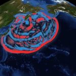
Historical Hurricane Track Viewer
Historical Hurricane Track Viewer >> Click Here To Launch Viewer The Historical Hurricane Viewer is an interactive tool to see historical hurricane tracking information. Features include: Search and display hurricane data by storm name, latitude and longitude coordinates, or geographic region View coastal … Read More…
Know The Hurricane Hazard Terms
Tropical?Cyclone: A warm-core non-frontal synoptic-scale cyclone, originating over tropical or subtropical waters, with organized deep convection and a closed surface wind circulation about a well-defined center. Once formed, a tropical cyclone is maintained by the extraction of heat energy from the ocean at … Read More…
3 Day Severe Weather Risk Issued May 7, 2015
Thursday May 7, 2015 Isolated to scattered severe storms are possible from the upper Mississippi Valley to the Southern Great Plains, mainly in the afternoon and evening Friday May 8, 2015 Severe thunderstorms will be possible Friday across portions of the Central and … Read More…
Satellite View of Changing Arctic
According to analysis by the National Snow and Ice Data Center, sea ice in the Arctic reached its annual minimum on September 17, 2014. At 5.02 million square kilometers or 1.94 million square miles, this was the sixth lowest amount of ice on … Read More…
TweetChat: Spring Weather Preparedness – April 29, 2PM ET #WxPrepChat
Spring has sprung, ushering in a new season of hazardous weather. Tornadoes, floods, thunderstorm winds, hail, lightning, heat, wildfires, rip currents and tsunamis are some of the of hazards that can be dangerous for the unprepared. Join us on Twitter Wednesday, April 29, from 2:00-3:00 PM … Read More…
Satellite Image of Calbuco Volcano Eruption in Chile
Calbuco Volcano in southern Chile has erupted for the first time since 1972, with the last major eruption occurring in 1961 that sent ash columns 12-15 kilometers high. This image was taken by the Suomi NPP satellite’s VIIRS instrument in a high resolution … Read More…
-
-
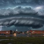
Thunderstorm Basics: Structure, Types, and Forecasting Methods
August 29, 2025
-
-
August 26, 2025
-
-
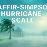
Saffir-Simpson Hurricane Wind Scale
June 9, 2025