
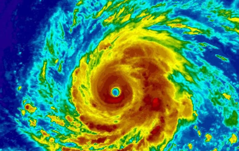
 Tropical?Cyclone: A warm-core non-frontal synoptic-scale cyclone, originating over tropical or subtropical waters, with organized deep convection and a closed surface wind circulation about a well-defined center. Once formed, a tropical cyclone is maintained by the extraction of heat energy from the ocean at high temperature and heat export at the low temperatures of the upper troposphere.
Tropical Depression: A tropical cyclone in which the maximum sustained surface wind speed (using the U.S. 1-minute average) is 38 mph (33 knot) or less.
Tropical Storm: A tropical cyclone in which the maximum sustained surface wind speed (using the U.S. 1-minute average) ranges from 39 mph (34 knots) to 73 mph (63 knots).
Hurricane: A tropical cyclone in which the maximum sustained surface wind (using the U.S. 1-minute average) is 74 mph (64 knots) or more.
Storm Surge: An abnormal rise in sea level accompanying a hurricane or other intense storm, and whose height is the difference between the observed level of the sea surface and the level that would have occurred in the absence of the cyclone. Storm surge is usually estimated by subtracting the normal or astronomic high tide from the observed storm tide.? Storm surge can reach heights well over 20 feet and can span hundreds of miles of coastline.
Storm Tide: The actual level of sea water resulting from the astronomic tide combined with the storm surge.
Hurricane Warning: An announcement that hurricane conditions (sustained winds of 74 mph or higher) are expected somewhere within the specified area. Because hurricane preparedness activities become difficult once winds reach tropical storm force, the hurricane warning is issued 36 hours in advance of the anticipated onset of tropical-storm-force winds.
Hurricane Watch: An announcement that hurricane conditions (sustained winds of 74 mph or higher) are possible within the specified area. Because hurricane preparedness activities become difficult once winds reach tropical storm force, the hurricane watch is issued 48 hours in advance of the anticipated onset of tropical-storm-force winds.
Tropical Storm Warning: An announcement that tropical storm conditions (sustained winds of 39 to 73 mph) are expected somewhere within the specified area within 36 hours.
Tropical Storm Watch: An announcement that tropical storm conditions (sustained winds of 39 to 73 mph) are possible within the specified area within 48 hours.
Short Term Watches and Warnings: These watches/warnings provide detailed information about specific hurricane threats, such as flash floods and tornadoes.
Tropical?Cyclone: A warm-core non-frontal synoptic-scale cyclone, originating over tropical or subtropical waters, with organized deep convection and a closed surface wind circulation about a well-defined center. Once formed, a tropical cyclone is maintained by the extraction of heat energy from the ocean at high temperature and heat export at the low temperatures of the upper troposphere.
Tropical Depression: A tropical cyclone in which the maximum sustained surface wind speed (using the U.S. 1-minute average) is 38 mph (33 knot) or less.
Tropical Storm: A tropical cyclone in which the maximum sustained surface wind speed (using the U.S. 1-minute average) ranges from 39 mph (34 knots) to 73 mph (63 knots).
Hurricane: A tropical cyclone in which the maximum sustained surface wind (using the U.S. 1-minute average) is 74 mph (64 knots) or more.
Storm Surge: An abnormal rise in sea level accompanying a hurricane or other intense storm, and whose height is the difference between the observed level of the sea surface and the level that would have occurred in the absence of the cyclone. Storm surge is usually estimated by subtracting the normal or astronomic high tide from the observed storm tide.? Storm surge can reach heights well over 20 feet and can span hundreds of miles of coastline.
Storm Tide: The actual level of sea water resulting from the astronomic tide combined with the storm surge.
Hurricane Warning: An announcement that hurricane conditions (sustained winds of 74 mph or higher) are expected somewhere within the specified area. Because hurricane preparedness activities become difficult once winds reach tropical storm force, the hurricane warning is issued 36 hours in advance of the anticipated onset of tropical-storm-force winds.
Hurricane Watch: An announcement that hurricane conditions (sustained winds of 74 mph or higher) are possible within the specified area. Because hurricane preparedness activities become difficult once winds reach tropical storm force, the hurricane watch is issued 48 hours in advance of the anticipated onset of tropical-storm-force winds.
Tropical Storm Warning: An announcement that tropical storm conditions (sustained winds of 39 to 73 mph) are expected somewhere within the specified area within 36 hours.
Tropical Storm Watch: An announcement that tropical storm conditions (sustained winds of 39 to 73 mph) are possible within the specified area within 48 hours.
Short Term Watches and Warnings: These watches/warnings provide detailed information about specific hurricane threats, such as flash floods and tornadoes. Know The Hurricane Hazard Terms
Tropical?Cyclone: A warm-core non-frontal synoptic-scale cyclone, originating over tropical or subtropical waters, with organized deep convection and a closed surface wind circulation about a well-defined center. Once formed, a tropical cyclone is maintained by the extraction of heat energy from the ocean at high temperature and heat export at the low temperatures of the upper troposphere.
Tropical Depression: A tropical cyclone in which the maximum sustained surface wind speed (using the U.S. 1-minute average) is 38 mph (33 knot) or less.
Tropical Storm: A tropical cyclone in which the maximum sustained surface wind speed (using the U.S. 1-minute average) ranges from 39 mph (34 knots) to 73 mph (63 knots).
Hurricane: A tropical cyclone in which the maximum sustained surface wind (using the U.S. 1-minute average) is 74 mph (64 knots) or more.
Storm Surge: An abnormal rise in sea level accompanying a hurricane or other intense storm, and whose height is the difference between the observed level of the sea surface and the level that would have occurred in the absence of the cyclone. Storm surge is usually estimated by subtracting the normal or astronomic high tide from the observed storm tide.? Storm surge can reach heights well over 20 feet and can span hundreds of miles of coastline.
Storm Tide: The actual level of sea water resulting from the astronomic tide combined with the storm surge.
Hurricane Warning: An announcement that hurricane conditions (sustained winds of 74 mph or higher) are expected somewhere within the specified area. Because hurricane preparedness activities become difficult once winds reach tropical storm force, the hurricane warning is issued 36 hours in advance of the anticipated onset of tropical-storm-force winds.
Hurricane Watch: An announcement that hurricane conditions (sustained winds of 74 mph or higher) are possible within the specified area. Because hurricane preparedness activities become difficult once winds reach tropical storm force, the hurricane watch is issued 48 hours in advance of the anticipated onset of tropical-storm-force winds.
Tropical Storm Warning: An announcement that tropical storm conditions (sustained winds of 39 to 73 mph) are expected somewhere within the specified area within 36 hours.
Tropical Storm Watch: An announcement that tropical storm conditions (sustained winds of 39 to 73 mph) are possible within the specified area within 48 hours.
Short Term Watches and Warnings: These watches/warnings provide detailed information about specific hurricane threats, such as flash floods and tornadoes.
This entry was posted in Basic Meteorology, Weather Articles and tagged Atlantic Hurricane Names, Atlantic Tropical Cyclone Reports Hurricane, Hurricane, hurricane names, hurricane warning, hurricane watch, hurricanes, national hurricane center, National Hurricane Center Tropical Cyclone Reports, short term watches and warnings, storm surge, storm tide, Tropical, tropical cyclone, tropical depression, tropical storm, tropical storm warning, tropical storm watch. Bookmark the permalink.
Read More

Southern Plains Severe Storms: SPC Slight Risk for Oklahoma and West Texas on October 14, 2026
Southern Plains severe storms are the main severe weather concern across the country on Wednesday, October 14, 2026, with the NOAA Storm Prediction Center placing Oklahoma City, Lawton and Ardmore in Oklahoma, along with Midland, Odessa…

Panama Earthquake: Magnitude 7.7 Strikes Near Pitaloza Arriba, USGS Issues RED Alert
USGS ShakeMap of the M7.7 Panama earthquake. The star marks the epicenter; red and orange contours show the strongest estimated shaking. Source: U.S. Geological Survey. A powerful Panama earthquake struck the Azuero Peninsula on Friday, October…

Hurricane Isaias Landfall Expected Tonight on the Northern Gulf Coast as Storm Nears Major Hurricane Strength
Hurricane Isaias position at 7 AM CDT Friday, October 9, 2026, with the NHC forecast track and cone toward the northern Gulf Coast and active coastal and inland warnings. Map: iAlert.com Hurricane Isaias landfall is expected…