View All Articles

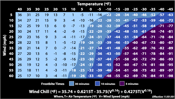
Wind Chill Chart

Wind chill temperature is a measure of the combined cooling effect of wind and temperature. As wind increases, heat is carried away from the body at a faster rate, driving down both the skin temperature and eventually the internal body temperature. The Wind Chill Temperature index is the measure of this relationship.? Below is the official National Weather Service wind chill chart for you to calculate your local wind chill. For current weather observations in your area click here and enter your location.

iAlert.com wind chill chart


Download Wind Chill Chart (PDF) | Download Wind Chill Brochure (PDF)

  More about wind chill:
This entry was posted in Basic Meteorology and tagged , , , , , , , , , , . Bookmark the permalink.

Leave a Reply

Read More

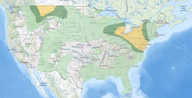
NOAA Storm Prediction Center categorical severe weather outlook for July 21, 2026, showing an Enhanced Risk (orange) over the Upper Ohio Valley into the Mid-Atlantic, ringed by Slight (yellow) and Marginal (green) risk areas across the eastern United States.

Upper Ohio Valley Severe Weather: Enhanced Risk July 21, 2026

Upper Ohio Valley severe weather is the headline threat on July 21, 2026, as the NOAA Storm Prediction Center (SPC) has issued an Enhanced Risk stretching from the Ohio Valley through the Mid-Atlantic and into the…

Read More

Upper Midwest severe thunderstorms categorical risk map for July 20, 2026, showing an SPC Enhanced Risk from Minnesota and Iowa across Wisconsin to the Great Lakes.

Upper Midwest Severe Thunderstorms: Enhanced Risk July 20, 2026

Upper Midwest severe thunderstorms are threatening Minnesota, Wisconsin, Iowa, Upper Michigan, and the broader Great Lakes region today, July 20, 2026, with the NOAA Storm Prediction Center placing the area under an Enhanced Risk, the third…

Read More

SPC Day 1 categorical severe weather outlook for July 19, 2026, showing Slight Risk areas for Southeast severe thunderstorms across the Carolinas, north Georgia, and southern Virginia, plus the Dakotas and western Minnesota.

Southeast Severe Thunderstorms and Dakotas Hail Threat: SPC Outlook for July 19, 2026

Southeast severe thunderstorms are the lead hazard in today's Storm Prediction Center Day 1 Convective Outlook, issued July 19, 2026, with the SPC placing a Slight Risk, the second of five severe categories (level 2 of…

Read More

Leave a Reply