
View All Articles

Rip Current Safety

Rip current awareness

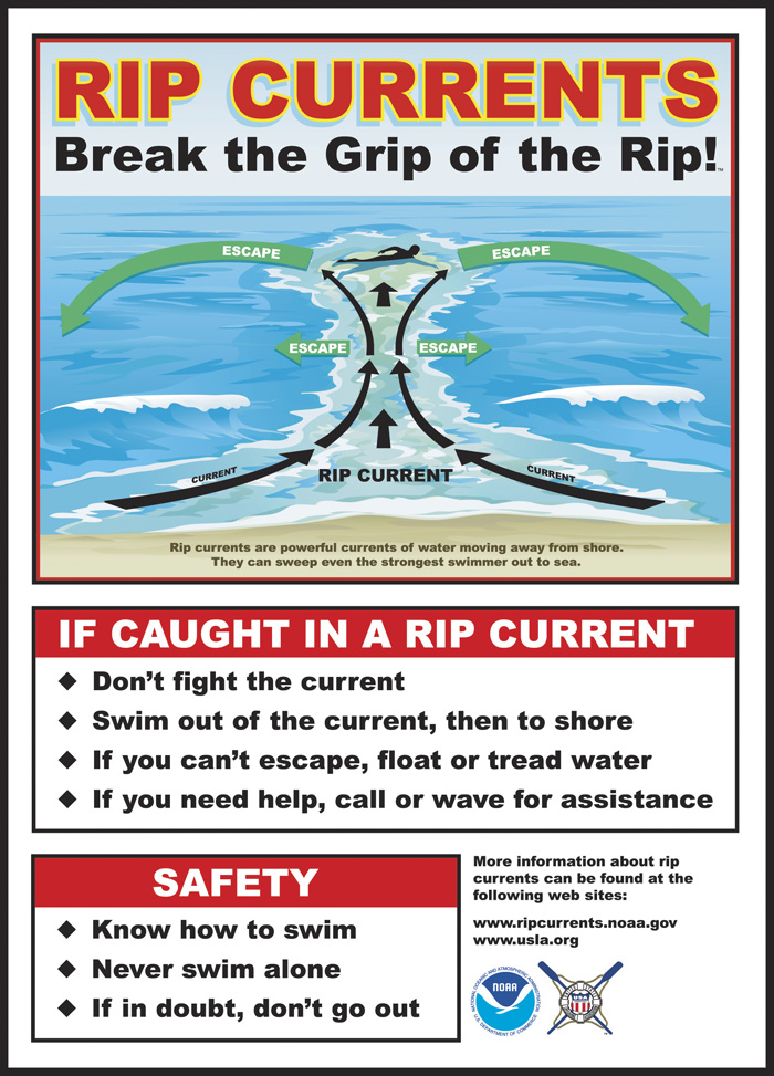
Rip Current Safety Chart (Click to Enlarge)

Stay safe at the beach this summer and know the signs of a rip current.

Rip Current:?“A small-scale surf-zone current moving away from the beach.? Rip currents form as waves disperse along the beach causing water to become trapped between the beach and a sandbar or other underwater feature.? The converges into a narrow, river-like channel moving away from the shore at high speed.” Although rip currents are not always obviously visible,? there are indicators to help you spot rip currents:
  • A channel of churning or choppy water
  • A line of sea foam, seaweed, or debris moving steadily out to sea
  • Different colored water beyond the surf zone
  • A break in the incoming wave pattern as waves roll onshore.

General characteristics of a rip current are shown in the photographs below:
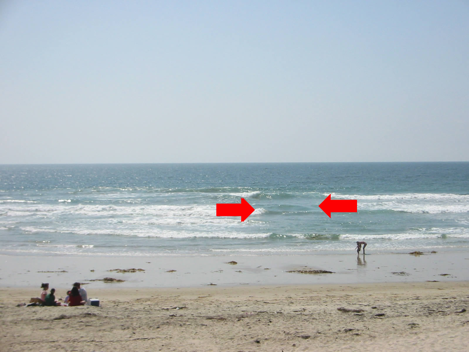
 
Rip current Example 1

Rip Current Example 1 (Click To Enlarge)
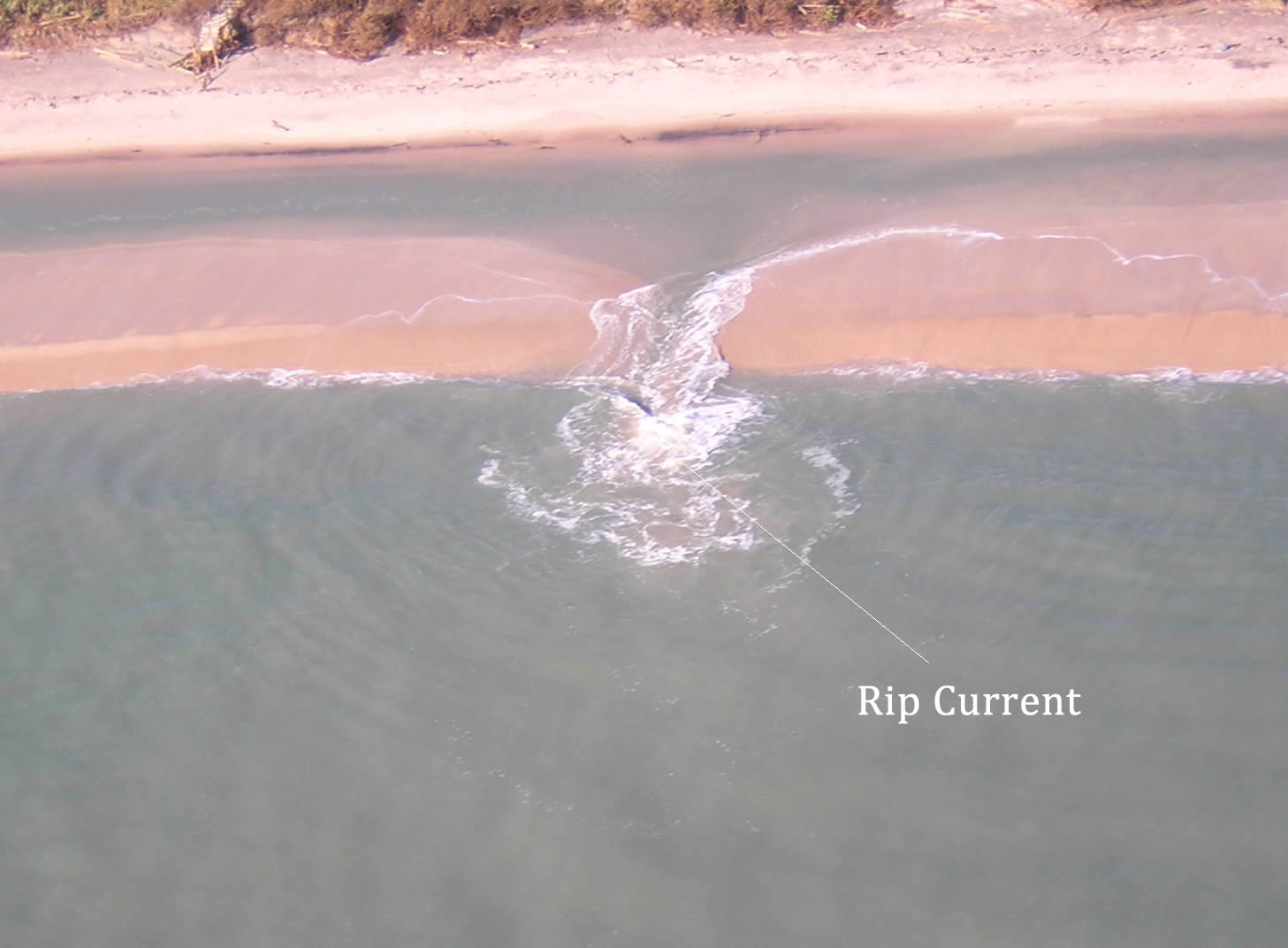
Rip current Example 3

Rip Current Example 2 (Click To Enlarge)
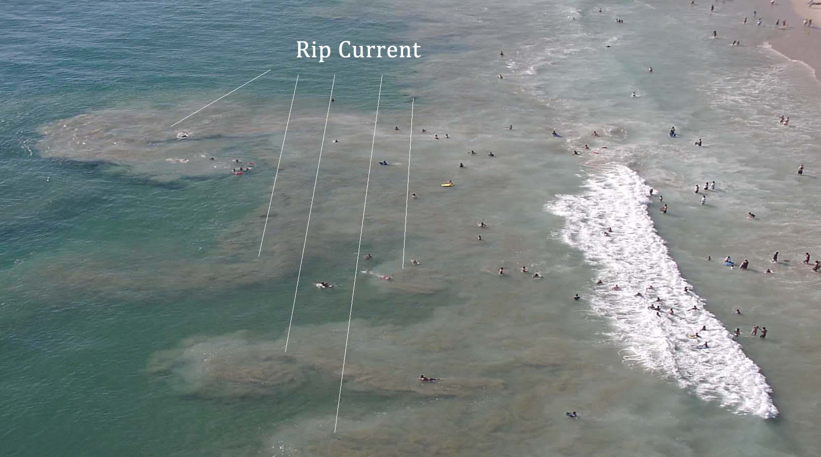
Rip current Example 2

Rip Current Example 3 (Click To Enlarge)

?What to do if caught in a rip current:

  • Stay calm
  • Swim along the shoreline, then on an angle back to shore
  • If unable to swim along the shore and out of rip current stay floating in rip current.? Eventually the pull will dissipate.? Turn around face shore, wave and yell for help.


Watch this Rip Current Awareness video:

This entry was posted in Weather Articles and tagged , , , , , , . Bookmark the permalink.

Leave a Reply

Read More

Mid-Atlantic severe thunderstorms wind risk map for July 4, 2026, showing SPC damaging wind probabilities up to 45 percent near Washington DC, Maryland, Virginia, and southern New Jersey

Mid-Atlantic Severe Thunderstorms Put Washington DC in Highest Wind Risk for July 4 Fireworks

Mid-Atlantic severe thunderstorms are the top weather threat on Independence Day, July 4, 2026, and Washington DC sits squarely inside the highest damaging wind risk in the country. The NOAA Storm Prediction Center has issued an…

Read More

Northern Plains severe thunderstorms wind risk map for July 2, 2026, showing a 30 percent damaging wind probability and significant severe area over the Dakotas and Minnesota

Northern Plains Severe Thunderstorms: Enhanced Risk Issued for July 2, 2026

Northern Plains severe thunderstorms are the top weather story on Thursday, July 2, 2026, as the NOAA Storm Prediction Center has placed portions of the northern Plains into the Upper Midwest under an Enhanced Risk, the…

Read More

Critical fire weather outlook from the SPC for July 1 and July 2, 2026, showing Elevated and Critical risk zones across the Southwest.

Critical Fire Weather Outlook: SPC Flags Dangerous Conditions June 30 Through July 2, 2026

Critical fire weather conditions are in place across portions of the United States from June 30 through July 2, 2026, according to a series of Day 1 and Day 2 Fire Weather Outlooks issued by the…

Read More

Leave a Reply
