
View All Articles

What mobile phone carriers does iAlert support to receive all hazard text alerts?

iAlert.com provides two options to receive local hazardous alerts such as severe thunderstorm warnings, tornado warnings, civil emergency messages, and more…..by email and/or by SMS text message to your mobile phone. ?As of January 2015 All major U.S. Mobile Carriers now work with iAlert SMS/Texting services. ?If you do not find your mobile carrier in the configuration list simply select “other” Additionally, any mobile phone capable of receiving text messages can be used with iAlert.com.? In other words you do not have to have a smartphone like an iPhone or Droid….however experience is always better with smartphones.

Click here to sign-up for an iAlert.com Account

NOTE:? Depending on your mobile plan, some companies charge for each text received and it is always recommended you sign-up for unlimited text messaging through your mobile company when using iAlert.com.? Any text message charges received on your mobile bill are between you and your mobile company and not iAlert.com.? iAlert.com is not directly connected to your mobile bill or mobile company.
This entry was posted in iAlert FAQ and tagged , , , , , , , , , , . Bookmark the permalink.

Leave a Reply

Read More

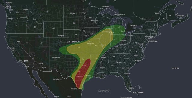
Moderate Risk flash flood map: WPC Day 1 Excessive Rainfall Outlook for October 1, 2026, with a Level 3 of 4 Moderate Risk from South Texas through San Antonio, Austin and Dallas-Fort Worth to southeast Oklahoma, and a Slight Risk from Texas to Wisconsin and Indiana

Moderate Risk Flash Flood: Dangerous Rain for Texas, Oct 1

iAlert weather analysis view of the WPC Day 1 Excessive Rainfall Outlook valid 7:00 am CDT Thursday, October 1, 2026, to 7:00 am CDT Friday, October 2. The innermost area is the Level 3 of 4…
Read More

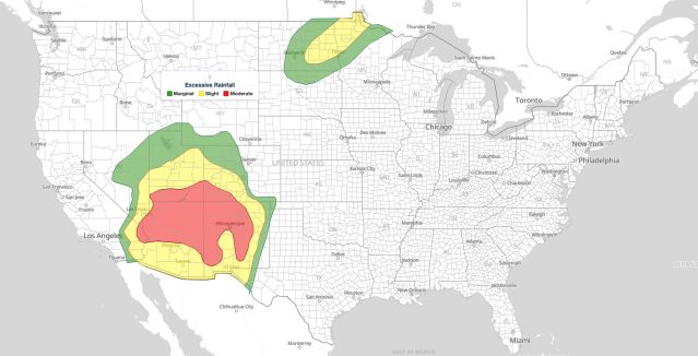
Moderate Risk flash flooding map: WPC Day 1 Excessive Rainfall Outlook for September 28, 2026, with a level 3 of 4 Moderate Risk over the Four Corners from the Colorado River to Albuquerque and Slight Risk over eastern North Dakota and northwest Minnesota

Moderate Risk Flash Flooding in the Southwest: WPC Level 3 of 4 Excessive Rainfall Outlook for September 28, 2026

WPC Day 1 Excessive Rainfall Outlook, 16Z update issued 11:33 am EDT Monday, September 28, 2026. Red marks the Moderate Risk flash flooding area (level 3 of 4) across the Four Corners, yellow the Slight Risk…
Read More

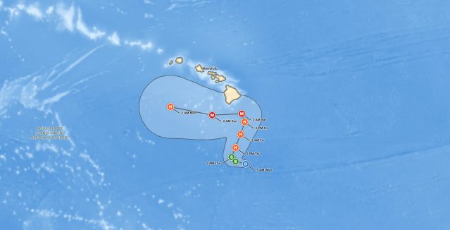
Big Island hurricane threat: National Hurricane Center forecast cone for Tropical Depression Fifteen-E, showing a Category 3 hurricane southeast of the Big Island of Hawaii early Saturday, September 26, 2026

Big Island Hurricane Threat: Tropical Depression Fifteen-E Forecast to Reach Major Hurricane Strength by Saturday

Forecast cone for the Big Island hurricane threat: Tropical Depression Fifteen-E is forecast to pass about 80 miles southeast of South Point as a Category 3 hurricane early Saturday. Source: NOAA National Hurricane Center, Advisory 12,…

Read More

Leave a Reply