
View All Articles

Local Storm Reports on iAlert.com

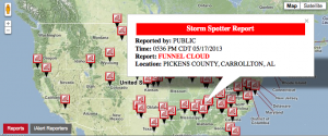
Real-time Local Storm Report Map

A Local Storm Report (LSR) is an event driven storm damage and observational report issued by the National Weather Service (NWS).  These reports are submitted to the local NWS office by trained storm spotters, amateur radio operators, storm chasers, law enforcement officials, and emergency management personnel.  The NWS uses these reports to track storm damage, verify warnings issued, or issue new warnings based on reports submitted.

Information found in these reports include:

  • Time/Date of event
  • Location (city, state, county)
  • Event type (Eg, Hail, funnel cloud, tornado, snow, and more)
  • Magnitude of event (Eg, size of hail, depth of snow, and more)
  • Reporting Source (Eg, Police, emergency manager, spotter, and more)

iAlert.com processes NWS Local Storm Reports and graphically displays the reports on the iAlert Reports Map or directly at http://LocalStormReports.com.


This entry was posted in iAlert Functionality, Weather Articles and tagged , , , , , , , , . Bookmark the permalink.

Leave a Reply

Read More

Mid-Atlantic severe thunderstorms wind risk map for July 4, 2026, showing SPC damaging wind probabilities up to 45 percent near Washington DC, Maryland, Virginia, and southern New Jersey

Mid-Atlantic Severe Thunderstorms Put Washington DC in Highest Wind Risk for July 4 Fireworks

Mid-Atlantic severe thunderstorms are the top weather threat on Independence Day, July 4, 2026, and Washington DC sits squarely inside the highest damaging wind risk in the country. The NOAA Storm Prediction Center has issued an…

Read More

Northern Plains severe thunderstorms wind risk map for July 2, 2026, showing a 30 percent damaging wind probability and significant severe area over the Dakotas and Minnesota

Northern Plains Severe Thunderstorms: Enhanced Risk Issued for July 2, 2026

Northern Plains severe thunderstorms are the top weather story on Thursday, July 2, 2026, as the NOAA Storm Prediction Center has placed portions of the northern Plains into the Upper Midwest under an Enhanced Risk, the…

Read More

Critical fire weather outlook from the SPC for July 1 and July 2, 2026, showing Elevated and Critical risk zones across the Southwest.

Critical Fire Weather Outlook: SPC Flags Dangerous Conditions June 30 Through July 2, 2026

Critical fire weather conditions are in place across portions of the United States from June 30 through July 2, 2026, according to a series of Day 1 and Day 2 Fire Weather Outlooks issued by the…

Read More

Leave a Reply
