View All Articles

What is frostbite?

Frostbite is freezing of the skin and underlying tissues. The lower the temperature, the quicker frostbite will occur. Frostbite typically affects the extremities, particularly the feet, toes, hands, fingers, ear lobes, or tip of the nose. The U.S. government’s Occupational Safety & Health Administration (OSHA) identifies the following for frostbite: OSHA Symptoms of frostbite:
  • Reddened skin develops gray/white patches.
  • Numbness in the affected part.
  • Feels firm or hard.
  • Blisters may occur in the affected part, in severe cases.
OSHA treatment of frostbite:
  • Do not rub the affected area to warm it because this action can cause more damage.
  • Do not apply snow/water. Do not break blisters.
  • Loosely cover and protect the area from contact.
  • Do not try to rewarm the frostbitten area before getting medical help; for example, do not place in warm water. If a frostbitten area is rewarmed and gets frozen again, more tissue damage will occur. It is safer for the frostbitten area to be rewarmed by medical professionals.
  • Give warm sweetened drinks, if the person is alert. Avoid drinks with alcohol.

This entry was posted in Basic Meteorology, Weather Glossary and tagged , , , , , , , . Bookmark the permalink.

Leave a Reply

Read More

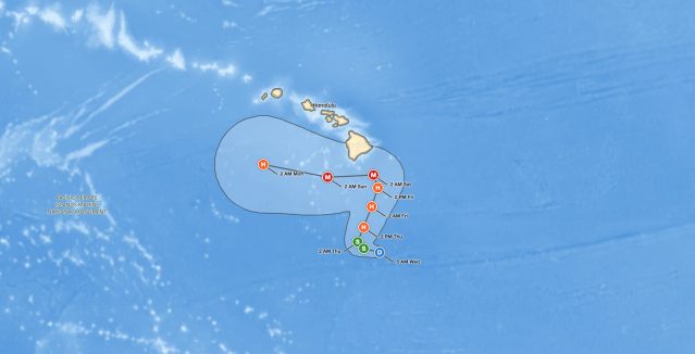
Tropical Storm Norbert forecast track on September 13, 2026, showing the 45 mph storm about 1,375 miles east of Hilo, Hawaii, weakening to a remnant low by Tuesday night

Tropical Storm Norbert Forecast: 45 mph Storm Weakens 1,375 Miles East of Hilo, Hawaii

iAlert hurricane tracker satellite view of the Tropical Storm Norbert forecast from the 11 AM HST advisory on Sunday, September 13, 2026, with the Hawaiian Islands highlighted. Green S markers show Norbert at tropical storm strength…

Read More

Tropical Storm Norbert forecast cone on September 12, 2026, tracking west over the East Pacific and weakening east of Hawaii

Tropical Storm Norbert Holds 60 mph Winds Far East of Hawaii, No Coastal Watches in Effect

iAlert hurricane tracker forecast track from the 5 AM HST advisory on Saturday, September 12, 2026. Green S markers show Norbert at tropical storm strength from Saturday through 2 AM Tuesday. Blue D markers show the…

Read More

Upper Midwest severe thunderstorms SPC categorical outlook map for September 11, 2026, showing a Slight Risk over northern and western Minnesota including Duluth, Bemidji, International Falls, and St. Cloud, a Marginal Risk from Minneapolis through eastern South Dakota and Nebraska, and a second Marginal Risk from Memphis and Nashville through Atlanta and the Carolinas to Virginia

Upper Midwest Severe Thunderstorms: Slight Risk of Large Hail, Damaging Wind, and Tornadoes September 11, 2026

Upper Midwest severe thunderstorms are the headline threat on September 11, 2026. The NOAA Storm Prediction Center's Day 1 Convective Outlook, issued at 12:26 UTC (8:26 am EDT / 7:26 am CDT), places Duluth, International Falls,…

Read More

Leave a Reply