View All Articles

What is the Difference Between a Flash Flood and a Flood?

A Flash Flood is a flood caused by heavy or excessive rainfall in a short period of time, generally less than 6 hours. Flash floods are usually characterized by raging torrents after heavy rains that rip through river beds, urban streets, or mountain canyons sweeping everything before them. They can occur within minutes or a few hours of excessive rainfall. They can also occur even if no rain has fallen, for instance after a levee or dam has failed, or after a sudden release of water by a debris or ice jam.  
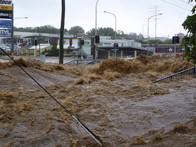
Flash Flood caused by heavy or excessive rainfall in a short period of time, generally less than 6 hours

A Flood is an overflow of water onto normally dry land. The inundation of a normally dry area caused by rising water in an existing waterway, such as a river, stream, or drainage ditch. Ponding of water at or near the point where the rain fell. Flooding is a longer term event than flash flooding: it may last days or weeks.  
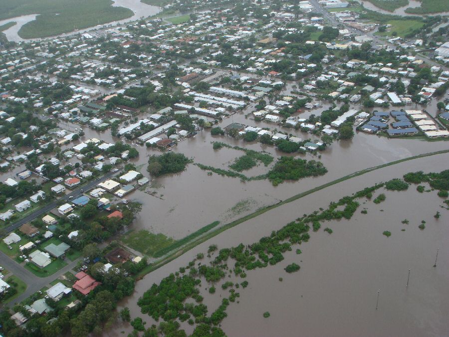
A Flood is an overflow of water onto normally dry land. The inundation of a normally dry area caused by rising water in an existing waterway, such as a river, stream, or drainage ditch.

Related Articles:

This entry was posted in Basic Meteorology and tagged , , , , , , , , , , , , , , , , , , . Bookmark the permalink.

Leave a Reply

Read More

NOAA Storm Prediction Center categorical severe weather outlook for July 21, 2026, showing an Enhanced Risk (orange) over the Upper Ohio Valley into the Mid-Atlantic, ringed by Slight (yellow) and Marginal (green) risk areas across the eastern United States.

Upper Ohio Valley Severe Weather: Enhanced Risk July 21, 2026

Upper Ohio Valley severe weather is the headline threat on July 21, 2026, as the NOAA Storm Prediction Center (SPC) has issued an Enhanced Risk stretching from the Ohio Valley through the Mid-Atlantic and into the…

Read More

Upper Midwest severe thunderstorms categorical risk map for July 20, 2026, showing an SPC Enhanced Risk from Minnesota and Iowa across Wisconsin to the Great Lakes.

Upper Midwest Severe Thunderstorms: Enhanced Risk July 20, 2026

Upper Midwest severe thunderstorms are threatening Minnesota, Wisconsin, Iowa, Upper Michigan, and the broader Great Lakes region today, July 20, 2026, with the NOAA Storm Prediction Center placing the area under an Enhanced Risk, the third…

Read More

SPC Day 1 categorical severe weather outlook for July 19, 2026, showing Slight Risk areas for Southeast severe thunderstorms across the Carolinas, north Georgia, and southern Virginia, plus the Dakotas and western Minnesota.

Southeast Severe Thunderstorms and Dakotas Hail Threat: SPC Outlook for July 19, 2026

Southeast severe thunderstorms are the lead hazard in today's Storm Prediction Center Day 1 Convective Outlook, issued July 19, 2026, with the SPC placing a Slight Risk, the second of five severe categories (level 2 of…

Read More

Leave a Reply


