View All Articles

Flood Safety: During a Flood

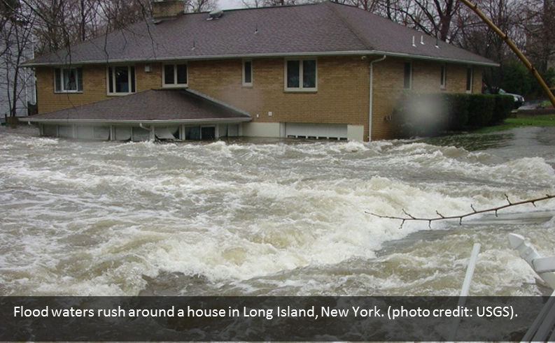
Flood Safety During a Flood Image During a flood, water levels and the rate the water is flowing can quickly change. Remain aware and monitor local radio and television outlets. Avoid flood waters at all costs and evacuate immediately when water starts to rise. Don’t wait until it’s too late! Durring?a Flood
  • Stay Informed:?Monitor local radio and television Sign-up for email or text alerts of active critical weather, internet and social media for information and updates.
  • Get to Higher Ground:?Get out of areas subject to flooding and get to higher ground immediately.
  • Obey Evacuation Orders:?If told to evacuate, do so immediately. Be sure to lock your home as you leave. If you have time, disconnect utilities and appliances.
  • Practice Electrical Safety:?Don’t go into a basement, or any room, if water covers the electrical outlets or if cords are submerged. If you see sparks or hear buzzing, crackling, snapping or popping noises –get out! Stay out of water that may have electricity in it!
  • Avoid Flood Waters:?Do not walk through flood waters. It takes only six inches of moving water to knock you off your feet. If you are trapped by moving water, move to the highest possible point and call 911 for help.

Related Articles:

Sign-up For Severe Weather Email/Text Alert Notification Services

This entry was posted in Emergency Preparedness, Weather Articles and tagged , , , , , , . Bookmark the permalink.

Leave a Reply

Read More

Hawaii tropical storm forecast track for Potential Tropical Cyclone One-C on August 13, 2026, showing the National Hurricane Center forecast cone crossing the Hawaiian Islands from Friday night into Monday with the center passing near Hilo and Honolulu

Hawaii Tropical Storm Threat: Potential Tropical Cyclone One-C Targets the Islands

Forecast track and cone for Potential Tropical Cyclone One-C, valid 12:00 UTC August 13, 2026 (2 a.m. HST). The track carries the center from east-southeast of the Big Island on Thursday to near or over the…

Read More

Iowa Illinois severe thunderstorms SPC Day 1 categorical risk map for August 13, 2026, showing a Slight Risk from Des Moines across Cedar Rapids, Davenport, Peoria, and Champaign, with a Marginal Risk wrapping from the central Plains into Indiana, Ohio, and Kentucky

Iowa Illinois Severe Thunderstorms: Slight Risk of Damaging Wind and Hail August 13, 2026

Iowa Illinois severe thunderstorms are the top convective concern in the NOAA Storm Prediction Center's Day 1 Outlook issued at 05:58 UTC on August 13, 2026. The SPC has drawn a Slight Risk, the second of…

Read More

Plains severe thunderstorms SPC categorical risk map for August 12, 2026, showing a Slight Risk from the northern and central High Plains across Nebraska and Iowa into Illinois, Indiana, and the lower Ohio Valley

Plains Severe Thunderstorms: Slight Risk of Large Hail and Damaging Wind From Iowa to the High Plains, August 12, 2026

Plains severe thunderstorms are the top weather story for Wednesday, August 12, 2026. The NOAA Storm Prediction Center has issued a Slight Risk, the second of five severe categories, from the central and northern High Plains…

Read More

Leave a Reply


