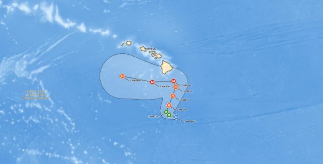
Big Island Hurricane Threat: Tropical Depression Fifteen-E Forecast to Reach Major Hurricane Strength by Saturday
Big Island hurricane threat grows: Fifteen-E, 320 miles south-southeast of South Point, Hawaii, could reach Category 3 by Saturday.
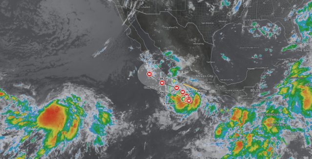
Tropical Storm Polo Rapidly Intensifying Off Southwestern Mexico, Major Hurricane Forecast by Tuesday
Tropical Storm Polo is rapidly intensifying 255 miles south-southeast of Manzanillo, Mexico, with 160 mph winds forecast by Wednesday.
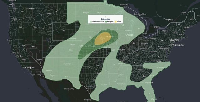
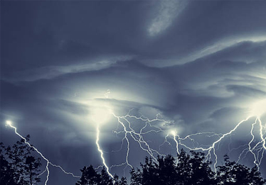
Nebraska Iowa Severe Storms: Slight Risk of Large Hail, Damaging Wind, and Tornadoes September 14, 2026
Nebraska Iowa severe storms Sept 14: SPC Slight Risk for eastern Nebraska and western Iowa with large hail, severe gusts, a few tornadoes.
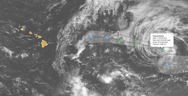
Tropical Storm Norbert Forecast: 45 mph Storm Weakens 1,375 Miles East of Hilo, Hawaii
Tropical Storm Norbert forecast: 45 mph winds about 1,375 miles east of Hilo, Hawaii, gradual weakening, no coastal watches in effect.
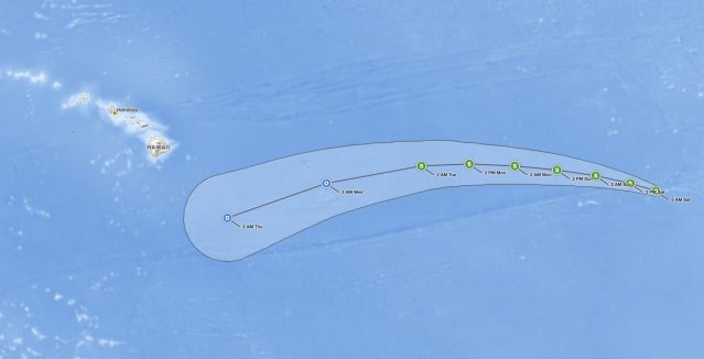
Tropical Storm Norbert Holds 60 mph Winds Far East of Hawaii, No Coastal Watches in Effect
Tropical Storm Norbert holds 60 mph winds over the open East Pacific, moving west-northwest with no coastal watches or warnings in effect.

Upper Midwest Severe Thunderstorms: Slight Risk of Large Hail, Damaging Wind, and Tornadoes September 11, 2026
Upper Midwest severe thunderstorms bring a Slight Risk to Duluth, Bemidji, and northern Minnesota Sept. 11, with large hail, damaging wind.
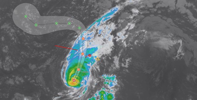
Hawaii Hurricane Lowell: Tropical Storm Watch Issued for Oahu as Category 3 Approaches Kauai
Hawaii Hurricane Lowell, a 115 mph Category 3 storm, threatens Kauai with a Hurricane Warning and Oahu with a Tropical Storm Watch as of Sept.
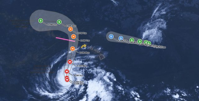
Hawaii Hurricane Lowell Remains Category 3 at 125 mph, Turns Toward Islands
Hawaii Hurricane Lowell is a 125 mph Category 3 storm tracking toward Kauai Monday night. Tropical Storm Watch in effect. Flash flood and surge.
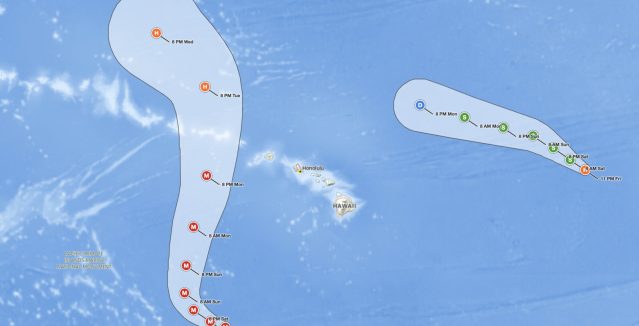
Hawaii Hurricane Lowell: 155 mph Cat 4 to Turn Toward Kauai
Hawaii Hurricane Lowell regained Category 5 strength Friday with 160 mph winds, located about 600 miles south of Honolulu.