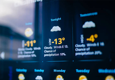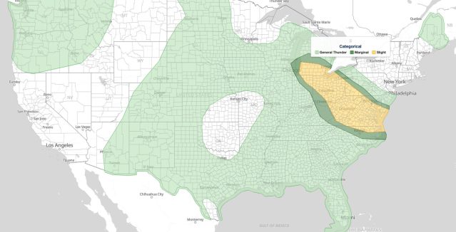
Great Lakes Mid-Atlantic Severe Thunderstorms: Slight Risk of Damaging Wind and Hail September 4, 2026
Great Lakes Mid-Atlantic severe thunderstorms threaten damaging wind gusts September 4, 2026. Columbus and Pittsburgh face the highest 30%.
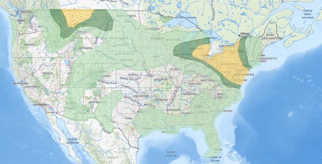
Great Lakes Mid-Atlantic Severe Thunderstorms: Slight Risk of Damaging Wind, Hail, and Tornadoes September 2, 2026
Great Lakes Mid-Atlantic severe thunderstorms bring a Slight Risk September 2, 2026. Damaging wind, large hail, and tornadoes possible.
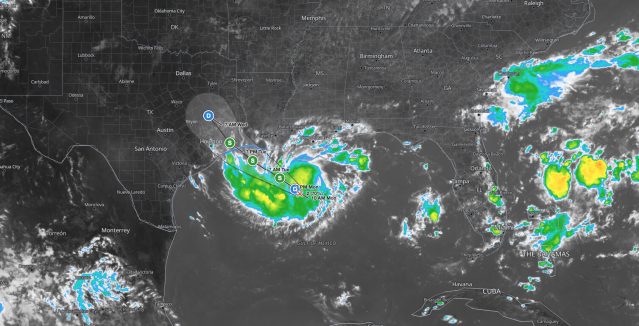
Gulf Coast Tropical Storm Warning: Potential Tropical Cyclone Five Targets Texas and Louisiana Tuesday
Gulf Coast tropical storm conditions are expected Tuesday as Potential Tropical Cyclone Five moves toward the upper Texas and southwestern.
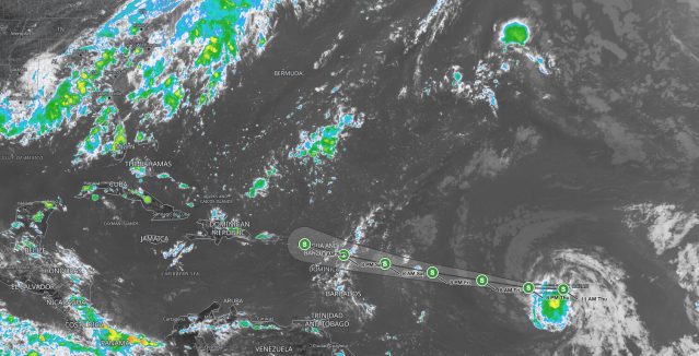
Tropical Storm Dolly Forms Over the Central Atlantic: Leeward Islands Should Monitor Progress
Tropical Storm Dolly forms over the central Atlantic with 40 mph winds. Leeward Islands, Puerto Rico, and Hispaniola face heavy rain and flash.
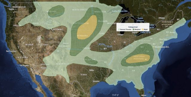
Plains Severe Thunderstorms: Slight Risk of Large Hail and Damaging Wind Across Nebraska, South Dakota, and the Southern Appalachians, August 17, 2026
Plains severe thunderstorms bring a Slight Risk of large hail and damaging wind across Nebraska, South Dakota, and the Southern Appalachians.
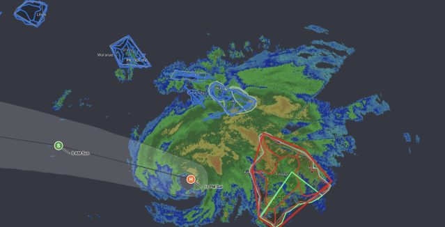
Hawaii Hurricane Lala: Damaging Winds and Life-Threatening Flooding Spread Across the Island Chain
Hawaii Hurricane Lala is bringing 75 mph winds and up to 25 inches of rain to the Big Island, with tropical storm conditions spreading to Maui, Oahu.
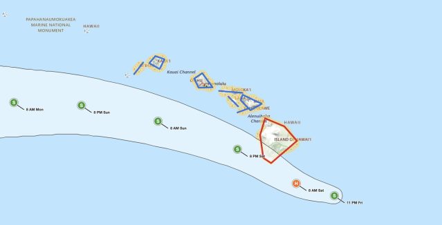
Hawaii Hurricane Lala: Big Island Faces Hurricane Conditions Saturday as Tropical Storm Strengthens
Hawaii Hurricane Lala is forecast to bring hurricane conditions to the Big Island Saturday. Heavy rain, storm surge, and life-threatening surf threaten.
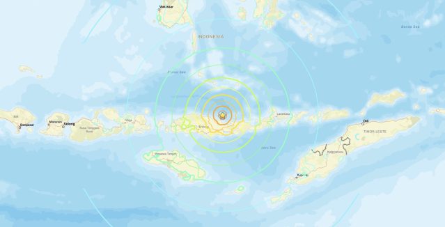
Indonesia Earthquake M7.7 Strikes Near Ende in the Flores Sea
Indonesia earthquake M7.7 struck near Ende on August 14, 2026. About 1.5 million people felt strong to severe shaking. Casualty and damage risk.
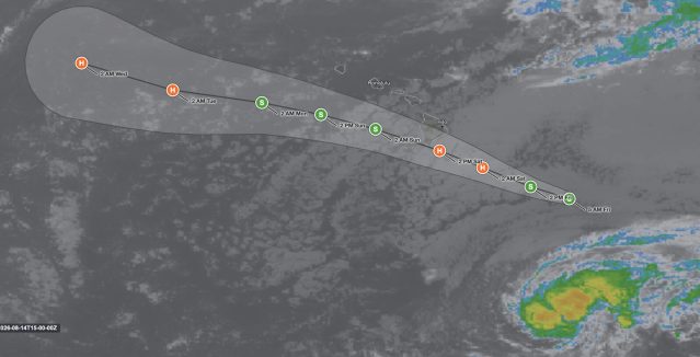
Hawaii Tropical Storm Lala: Hurricane Warning Issued for Big Island as Storm Approaches
Hawaii tropical storm Lala is approaching the Big Island with 60 mph winds and a Hurricane Warning in effect. Life-threatening flooding and surf.