View All Articles

Flood Safety: After a Flood

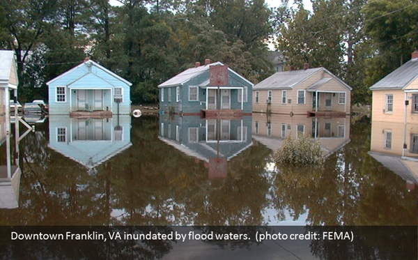
Flood Safety After a Flood When flood waters recede, the damage left behind can be devastating and present many dangers. Images of flood destruction depict destroyed homes and buildings, damaged possessions, and decimated roadways. However, what you can’t see can be just as dangerous. Floodwaters often become contaminated with sewage or chemicals. Gas leaks and live power lines can be deadly, but are not obvious at first glance.

After a Flood?

  • Stay Informed:  Stay tuned to your local news for updated information on road conditions. Ensure water is safe to drink, cook or clean with after a flood. Oftentimes a boil water order is put in place following a flood. Check with utility companies to find out when electricity or gas services may be restored. Carbon monoxide poisoning is one of the leading causes of death after storms when areas are dealing with power outages. Never use a portable generator inside your home or garage. Review generator safety.
  • Avoid Flood Waters:  Standing water hides many dangers including toxins and chemicals. There may be debris under the water and the road surface may have been compromised.
  • Avoid Disaster Areas: Do not visit disaster areas! Your presence may hamper rescue and other emergency operations.
  • Heed Road Closed and Cautionary Signs:  Road closure and other cautionary signs are put in place for your safety. Pay attention to them!
  • Wait for the “All Clear”: Do not enter a flood damaged home or building until you’re given the all clear by authorities. Water can compromise the structural integrity and its foundation and active electrical systems in contact with water is deadly.
  • Contact Family and Friends:  Let your family and close friends know that you’re okay so they can help spread the word. Register with or search the American Red Cross Safe and Well listings.

Related Articles:

This entry was posted in Emergency Preparedness and tagged , , , , , , . Bookmark the permalink.

Leave a Reply

Read More

Hawaii tropical storm forecast track for Potential Tropical Cyclone One-C on August 13, 2026, showing the National Hurricane Center forecast cone crossing the Hawaiian Islands from Friday night into Monday with the center passing near Hilo and Honolulu

Hawaii Tropical Storm Threat: Potential Tropical Cyclone One-C Targets the Islands

Forecast track and cone for Potential Tropical Cyclone One-C, valid 12:00 UTC August 13, 2026 (2 a.m. HST). The track carries the center from east-southeast of the Big Island on Thursday to near or over the…

Read More

Iowa Illinois severe thunderstorms SPC Day 1 categorical risk map for August 13, 2026, showing a Slight Risk from Des Moines across Cedar Rapids, Davenport, Peoria, and Champaign, with a Marginal Risk wrapping from the central Plains into Indiana, Ohio, and Kentucky

Iowa Illinois Severe Thunderstorms: Slight Risk of Damaging Wind and Hail August 13, 2026

Iowa Illinois severe thunderstorms are the top convective concern in the NOAA Storm Prediction Center's Day 1 Outlook issued at 05:58 UTC on August 13, 2026. The SPC has drawn a Slight Risk, the second of…

Read More

Plains severe thunderstorms SPC categorical risk map for August 12, 2026, showing a Slight Risk from the northern and central High Plains across Nebraska and Iowa into Illinois, Indiana, and the lower Ohio Valley

Plains Severe Thunderstorms: Slight Risk of Large Hail and Damaging Wind From Iowa to the High Plains, August 12, 2026

Plains severe thunderstorms are the top weather story for Wednesday, August 12, 2026. The NOAA Storm Prediction Center has issued a Slight Risk, the second of five severe categories, from the central and northern High Plains…

Read More

Leave a Reply


