View All Articles

Hurricane Laura to Make Landfall as a Major Hurricane in the Gulf of Mexico Early Thursday Morning

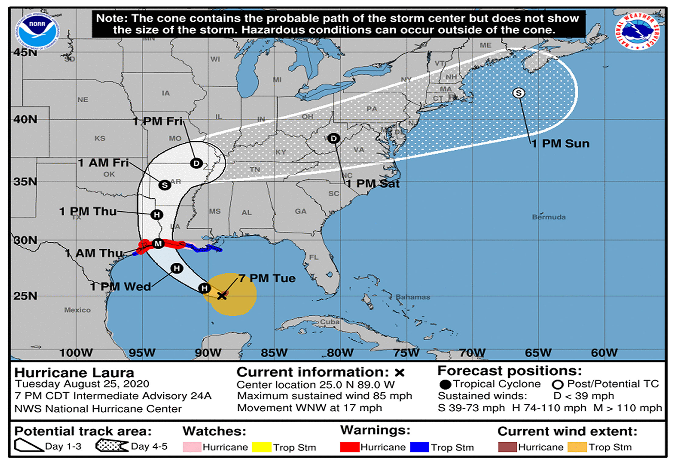
There is a danger of life-threatening storm surge with large dangerous waves producing potentially catastrophic damage from San Luis Pass, Texas, to the Mouth of the Mississippi River, including areas inside the Port Arthur Hurricane Flood Protection system.  This surge could penetrate up to 30 miles inland from the immediate coastline in southwestern Louisiana and far southeastern Texas.  Actions to protect life and property should be rushed to completion as water levels will begin to rise on Wednesday. 
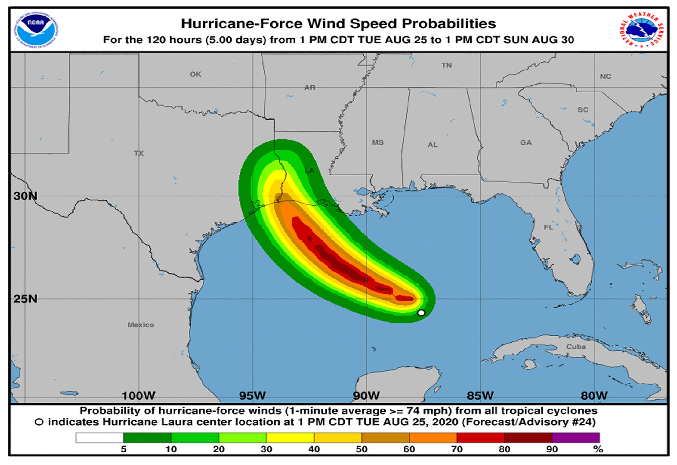
Hurricane-force winds are expected Wednesday night in the warning area from San Luis Pass, Texas, to west Morgan City, Louisiana, and the strongest winds associated with Laura’s eyewall will occur somewhere within this area.  Hurricane-force winds and widespread damaging wind gusts are also expected to spread well inland into portions of eastern Texas and western Louisiana early Thursday 
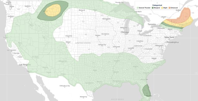
The threat of wingspread flash and urban flooding along with small streams overflowing their banks will increase due to heavy rainfall Wednesday night into Thursday from far eastern Texas, across Louisiana, and Arkansas.  This will also result in minor to isolated moderate river flooding.  The heavy rainfall threat will spread northeastward into the middle-Mississippi, lower Ohio and Tennessee Valleys Friday night and Saturday.

Related Articles:

This entry was posted in News & Events, Weather Articles and tagged , , , . Bookmark the permalink.

Leave a Reply

Read More

Severe weather June 22, 2026 SPC Day 1 Convective Outlook map showing Slight, Marginal, and General Thunderstorm risk areas from the High Plains to the Mid-Atlantic.

Severe Weather June 22, 2026: SPC Issues Slight Risk Convective Outlook

Severe weather June 22, 2026 is possible as the NOAA Storm Prediction Center (SPC) has issued a Day 1 Convective Outlook carrying a Slight Risk, the second of five risk categories. The outlook identifies General Thunderstorm,…

Read More

entral Plains severe weather outlook for June 20, 2026 showing the SPC Day 1 Enhanced Risk over eastern Colorado, western Kansas, and southern Nebraska

Central Plains Severe Weather: Enhanced Risk of Large Hail, Damaging Winds, and Flash Flooding June 20

Central Plains severe weather is forecast to strike eastern Colorado, western and central Kansas, and southern Nebraska on Saturday, June 20, 2026, with the Storm Prediction Center (SPC) issuing an Enhanced Risk outlook for the region.…

Read More

Potential Tropical Cyclone One NHC forecast track and cone of uncertainty from Corpus Christi, Texas to Alexandria, Louisiana

Potential Tropical Cyclone One Brings Life-Threatening Flooding to Texas and Louisiana

Potential Tropical Cyclone One is producing life-threatening and dangerous flash flooding across portions of Texas and Louisiana as of Tuesday, June 16, 2026. The National Hurricane Center in Miami classified the system as a potential tropical…

Read More

Leave a Reply