View All Articles

Hurricane Laura Social Media Storm Reports

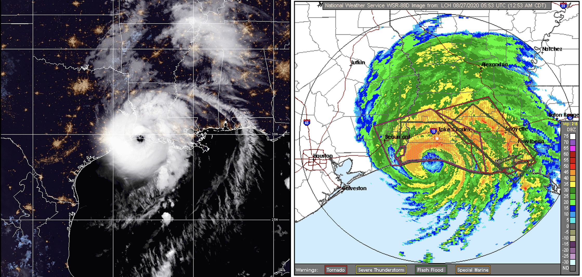
Hurricane Laura made landfall near Cameron, Louisiana around 1:00 am CDT on August 27, 2020 as a strong Category 4 storm with sustained of 150 mph he strongest land-falling system to reach the state of Louisiana in over 164 years.  Hurricane warnings also forecast storm surges of 15 ft warning Hurricane Laura is “unsurvivable”.

Hurricane Laura Social Media Storm Reports:

 
Hurricane Laura Damage Sulphur Louisiana
 
Chemical Fire Lake Charles, Louisiana Lake Charles, Louisiana
Downtown Lake Charles near Olive & Indigo jewelry Lake Charles, Louisiana
Hackberry, Louisiana Hurricane Laura
 
Lake Charles, Louisiana Cameron, Louisiana
 
EMS and rescue headed toward Louisiana on I-10 West Lake Charles, Louisiana
Lake Charles, Louisiana Lake Charles, Louisiana
Lake Charles, Louisiana Capitol One Tower Lake Charles, Louisiana Casino
 
Near Sulphur, Louisiana Near Lake Charles, Louisiana
 
Near Lake Charles, Louisiana Near Lake Charles, Louisiana

Related Articles:

This entry was posted in Weather Articles and tagged , , . Bookmark the permalink.

Leave a Reply

Read More

Northeast severe thunderstorms categorical outlook for July 14, 2026: SPC Enhanced Risk over northern New York, Vermont, and Maine.

Northeast Severe Thunderstorms Threaten Northern New York and New England on July 14

Northeast severe thunderstorms are set to impact northern New York and northern New England on July 14, 2026, as the NOAA Storm Prediction Center has issued an Enhanced Risk outlook covering the region. The Enhanced Risk…

Read More

Mid-Atlantic severe thunderstorms wind risk map for July 4, 2026, showing SPC damaging wind probabilities up to 45 percent near Washington DC, Maryland, Virginia, and southern New Jersey

Mid-Atlantic Severe Thunderstorms Put Washington DC in Highest Wind Risk for July 4 Fireworks

Mid-Atlantic severe thunderstorms are the top weather threat on Independence Day, July 4, 2026, and Washington DC sits squarely inside the highest damaging wind risk in the country. The NOAA Storm Prediction Center has issued an…

Read More

Northern Plains severe thunderstorms wind risk map for July 2, 2026, showing a 30 percent damaging wind probability and significant severe area over the Dakotas and Minnesota

Northern Plains Severe Thunderstorms: Enhanced Risk Issued for July 2, 2026

Northern Plains severe thunderstorms are the top weather story on Thursday, July 2, 2026, as the NOAA Storm Prediction Center has placed portions of the northern Plains into the Upper Midwest under an Enhanced Risk, the…

Read More

Leave a Reply



