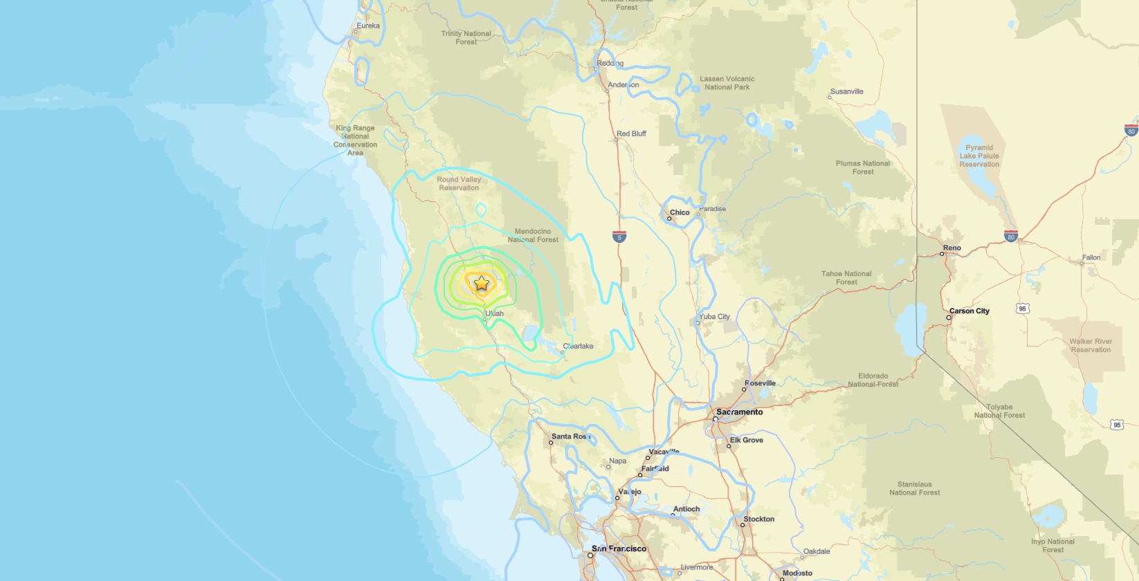
The Redwood Valley earthquake, a magnitude 5.6 event, struck northern California on June 24, 2026, at 15:10 UTC (8:10 a.m. local time), centered 11 kilometers north of Redwood Valley in Mendocino County. The U.S. Geological Survey issued a Yellow PAGER Alert and recorded a maximum ShakeMap intensity of VII (Very Strong), indicating the potential for moderate to significant damage near the epicenter.
Key points:
- Magnitude 5.6 earthquake struck 11 km north of Redwood Valley, CA.
- USGS issued a Yellow PAGER Alert, signaling possible damage.
- ShakeMap and Did You Feel It? reports both reached intensity VII.
- Depth was shallow at 8.07 km (5.01 miles), amplifying surface shaking.
- Event occurred June 24, 2026, at 15:10:40 UTC.
What the USGS Data Shows About the Redwood Valley Earthquake
The USGS located the epicenter at 39.364°N, 123.229°W, placing it in a sparsely populated stretch of Mendocino County wine country. The shallow depth of just over 8 kilometers is a critical detail: the shallower a quake, the less the seismic energy spreads out before reaching the surface, meaning ground shaking is more intense than a deeper event of equal magnitude would produce.
A ShakeMap intensity of VII on the Modified Mercalli Intensity scale corresponds to shaking that most people find difficult to stand through, with potential for damage to older or unreinforced structures. The Did You Feel It? community responses also peaked at VII, corroborating the instrumental data. The Yellow PAGER Alert level suggests a meaningful probability of localized casualties and economic losses, though exact figures require ground-truth surveys.
Northern California Seismic Context
Mendocino County sits in one of the most seismically active regions in the continental United States. The area sits near the Mendocino Triple Junction, where the Pacific, North American, and Gorda tectonic plates converge. This complex tectonic environment produces frequent earthquakes across a wide magnitude range, and M5+ events capable of causing damage are not uncommon here.
The Redwood Valley earthquake is a reminder that northern California’s fault network extends well beyond the famous San Andreas system. Local faults such as the Maacama and Bartlett Springs fault zones run through Mendocino and Lake counties and are capable of generating significant seismic events. Residents in these areas should maintain earthquake preparedness year-round.
Hazard Analysis
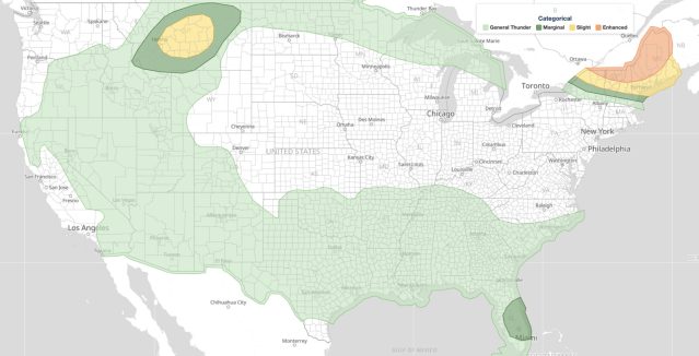
While earthquakes fall outside traditional meteorology, seismic and weather hazards often intersect in post-event scenarios. A M5.6 Redwood Valley earthquake with intensity VII shaking can dislodge hillside debris, and if significant rain events follow in the coming weeks, pre-loosened slopes become landslide risks. Mendocino County’s terrain makes this a real secondary concern worth monitoring.
From a hazard-communication standpoint, the USGS PAGER Yellow Alert is the key public signal here. It sits above the Green (little risk) threshold and tells emergency managers to expect some level of damage response. Aftershocks are statistically likely following any M5+ event, and some can approach or match the mainshock in magnitude within the first hours to days.
How to Stay Safe: Redwood Valley Earthquake Guidance
If you felt the Redwood Valley earthquake, the standard Drop, Cover, and Hold On protocol applies during any shaking. After the shaking stops, check for gas leaks, structural damage, and downed power lines before re-entering any building. Stay away from chimneys, which are particularly vulnerable in unreinforced masonry structures common in older rural California communities.
Expect aftershocks. A M5.6 mainshock statistically produces aftershocks, some potentially above M4, in the days that follow. Keep shoes near your bed, secure heavy furniture, and keep a go-bag accessible. Monitor active alerts and local emergency broadcasts for updated information.
If you are traveling near Redwood Valley or Mendocino County, check road conditions before driving. Shaking of this intensity can crack pavement, shift bridge approaches, and trigger rockfalls on mountain highways. Caltrans and local county roads departments may issue closures in the hours following the event.
Sources: