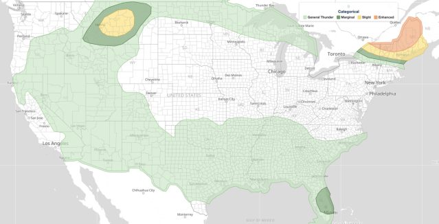
Kansas Oklahoma severe weather is escalating Thursday afternoon, June 25, 2026, with the NOAA Storm Prediction Center flagging a 60 percent probability of tornado watch issuance across south-central and southeast Kansas, north-central and northeast Oklahoma, and southwest Missouri. The SPC warns that storms capable of “all hazards” are expected to intensify through the afternoon, with local news reporting 75 mph wind gusts among the top threats.
Key points:
- SPC gives 60% odds of a tornado watch for parts of KS, OK, and MO.
- Threat window runs from roughly 12:38 PM to 8:15 PM CDT on June 25, 2026.
- All hazards are possible: tornadoes, large hail, and damaging winds up to 75 mph.
- Affected areas include south-central/southeast Kansas and north-central/northeast Oklahoma.
- Southwest Missouri is also included in the elevated severe weather zone.
What the SPC Is Saying About Kansas Oklahoma Severe Weather
The Storm Prediction Center issued Mesoscale Discussion 1309 at 12:38 PM CDT Thursday, valid through approximately 8:15 PM CDT. The discussion covers a broad swath of the south-central Plains, specifically calling out south-central and southeast Kansas, north-central and northeast Oklahoma, and southwest Missouri as areas where severe storm potential is expected to ramp up through the afternoon hours. A probability of 60 percent for watch issuance is a meaningful signal: the SPC typically reserves mesoscale discussions for situations where conditions are already organizing and the environment is sufficiently threatening to warrant close monitoring. Check current active weather alerts for your area to stay informed as watches or warnings are issued.
Oklahoma-based television station KOCO separately reported a timeline of storm hazards for Thursday, highlighting a tornado risk alongside the threat of 75 mph wind gusts. The 75 mph figure aligns with what meteorologists classify as a significant damaging-wind event, well above the 58 mph threshold that defines severe thunderstorm criteria.
Why This Region Faces Kansas Oklahoma Severe Weather So Often
The Kansas-Oklahoma border region sits at the heart of Tornado Alley for good reason. In late June, the low-level jet stream frequently surges northward overnight and into the afternoon, pumping Gulf of Mexico moisture into the southern Plains. When that moisture collides with a dryline or outflow boundary, storms can rapidly become supercells, capable of producing all three classic severe hazards: large hail, damaging straight-line winds, and tornadoes.
A 60 percent mesoscale discussion probability reflects that storm-scale ingredients, such as wind shear, instability, and lift, are coming into alignment but not yet explosive. Forecasters watch subsequent model runs and surface observations closely at this stage. If those parameters tighten further, a watch issuance follows quickly, sometimes within an hour of the discussion.
Meteorologist’s Take
The “all hazards” language in SPC MD 1309 is significant. It means the atmosphere is not locked into one threat type. Supercells that develop in strongly sheared environments like this one can produce large hail early in their life cycle, transition into tornadoes as the low-level rotation tightens, and then produce damaging bow-echo winds as the storm system evolves. Residents should not assume that because a tornado has not touched down, the danger has passed.
The afternoon timing of this Kansas Oklahoma severe weather event adds complexity. Daytime heating maximizes instability during the hours when most people are active and away from shelter. Evening and overnight events are dangerous because people are asleep, but peak-heating afternoon events catch commuters, outdoor workers, and children at school or sports practice in exposed positions. Having a plan before storms arrive matters more than reacting once warnings are issued.
For a deeper look at how SPC risk categories are defined and what each level means for your safety, see the iAlert guide to SPC outlook risk categories.
How to Stay Safe During Kansas Oklahoma Severe Weather
If you are in south-central or southeast Kansas, north-central or northeast Oklahoma, or southwest Missouri on Thursday afternoon, take these steps now, before storms develop.
- Identify your shelter: Know the lowest interior room of a sturdy building near you. Mobile homes are not safe during tornado warnings.
- Charge your devices: A fully charged phone with weather alerts enabled is your primary warning tool.
- Avoid travel: The period between roughly 1:00 PM and 8:00 PM CDT carries the highest risk. Delay non-essential travel if possible.
- Prepare for wind damage: Secure loose outdoor objects. Winds at 75 mph can turn patio furniture and debris into projectiles.
- Monitor radar continuously: Use live radar and alerts at iAlert to track storm movement in real time.
The Kansas Oklahoma severe weather situation will evolve rapidly through Thursday evening. Residents in all three states named in SPC MD 1309 should treat this as an active threat and remain weather-aware until the discussion’s expiration time passes and no further products are issued. Stay connected to official NWS products and trusted local sources for the latest updates.
Sources: