View All Articles

2011 Hurricane Names | 2011 National Hurricane Center Tropical Cyclone Reports

Hurricanes are named alphabetically from a predetermined list beginning the letter “A” through “W”, excluding names that begin with “Q” or “U.” A storm is first named by the National Hurricane Center when the system becomes a tropical storm and the name remains as it develops into a hurricane or until it dissipates. The most devastating hurricane names are retired and another name replaces it.  

2011 Hurricane Names:

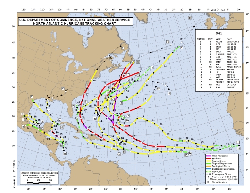
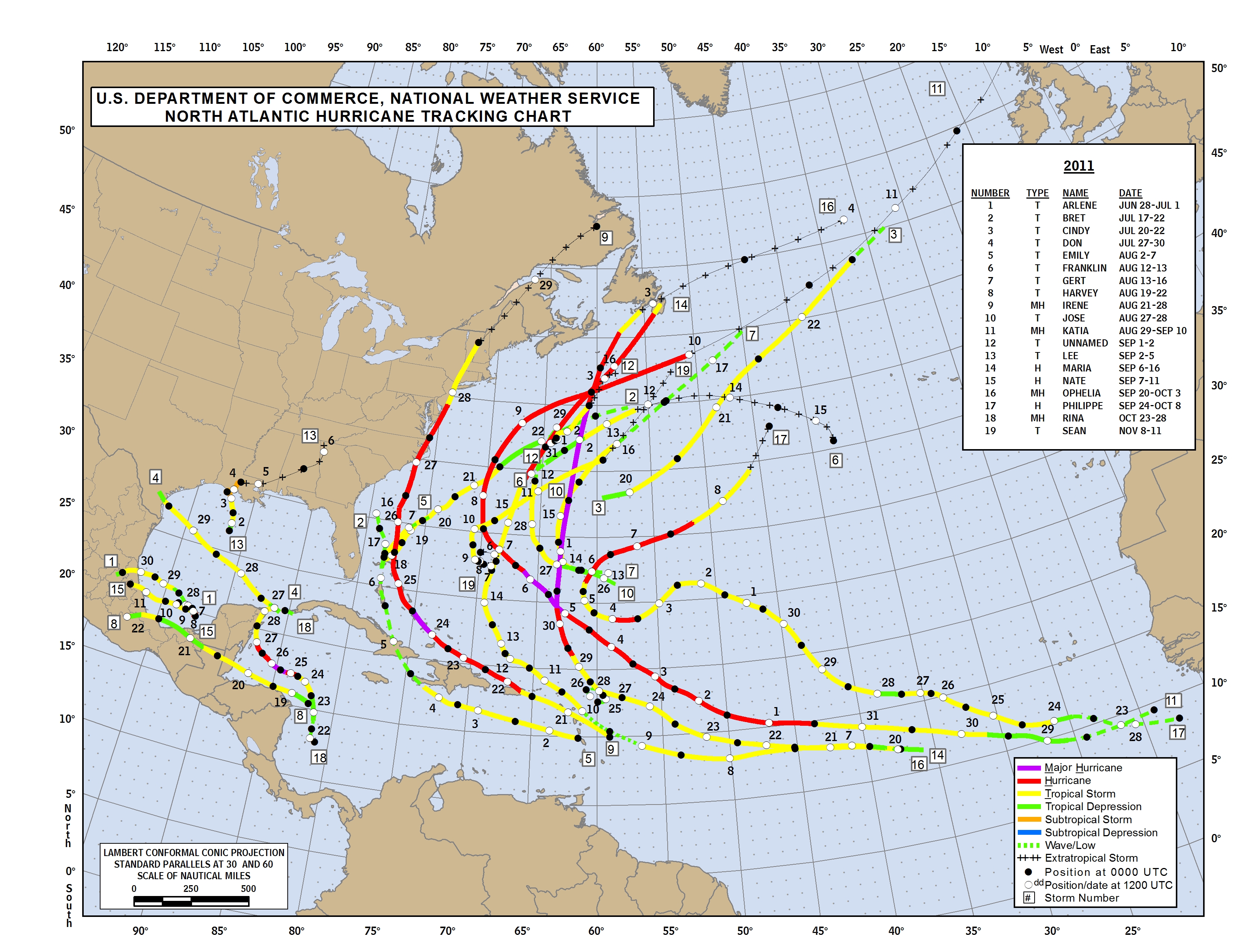
Arlene Bret Cindy Don Emily Franklin Gert Harvey Irene Jose Katia Lee Maria Nate Ophelia Philippe Rina Sean Tammy Vince Whitney 2011 Named Hurricane Tracks
 

2011 National Hurricane Center Tropical Cyclone Reports:

  • Tropical Storm Arlene – PDFKMZ
  • Tropical Storm Bret – PDFKMZ
  • Tropical Storm Cindy – PDFKMZ
  • Tropical Storm Don – PDFKMZ
  • Tropical Storm Emily – PDFKMZ
  • Tropical Storm Franklin – PDFKMZ
  • Tropical Storm Gert – PDFKMZ
  • Tropical Storm Harvey – PDFKMZ
  • Hurricane Irene – PDFKMZ
  • Tropical Depression Ten – PDFKMZ
  • Tropical Storm Jose – PDFKMZ
  • Hurricane Katia – PDFKMZ
  • Unnamed Tropical Storm1PDFKMZ
  • Tropical Storm Lee – PDFKMZ
  • Hurricane Maria – PDFKMZ
  • Hurricane Nate2PDFKMZ
  • Hurricane Ophelia – PDFKMZ
  • Hurricane Philippe – PDFKMZ
  • Hurricane Rina – PDFKMZ
  • Tropical Storm Sean – PDFKMZ
  1. This unnamed tropical storm was identified in post-season analysis.
  2. Nate was reclassified to hurricane status in post-storm analysis.
Click here to review past Tropical Cyclone Reports  

This entry was posted in Weather Articles and tagged , , , , , , , , , , , , , , , , , , , , , , , , . Bookmark the permalink.

Leave a Reply

Read More

NOAA Storm Prediction Center categorical severe weather outlook for July 21, 2026, showing an Enhanced Risk (orange) over the Upper Ohio Valley into the Mid-Atlantic, ringed by Slight (yellow) and Marginal (green) risk areas across the eastern United States.

Upper Ohio Valley Severe Weather: Enhanced Risk July 21, 2026

Upper Ohio Valley severe weather is the headline threat on July 21, 2026, as the NOAA Storm Prediction Center (SPC) has issued an Enhanced Risk stretching from the Ohio Valley through the Mid-Atlantic and into the…

Read More

Upper Midwest severe thunderstorms categorical risk map for July 20, 2026, showing an SPC Enhanced Risk from Minnesota and Iowa across Wisconsin to the Great Lakes.

Upper Midwest Severe Thunderstorms: Enhanced Risk July 20, 2026

Upper Midwest severe thunderstorms are threatening Minnesota, Wisconsin, Iowa, Upper Michigan, and the broader Great Lakes region today, July 20, 2026, with the NOAA Storm Prediction Center placing the area under an Enhanced Risk, the third…

Read More

SPC Day 1 categorical severe weather outlook for July 19, 2026, showing Slight Risk areas for Southeast severe thunderstorms across the Carolinas, north Georgia, and southern Virginia, plus the Dakotas and western Minnesota.

Southeast Severe Thunderstorms and Dakotas Hail Threat: SPC Outlook for July 19, 2026

Southeast severe thunderstorms are the lead hazard in today's Storm Prediction Center Day 1 Convective Outlook, issued July 19, 2026, with the SPC placing a Slight Risk, the second of five severe categories (level 2 of…

Read More

Leave a Reply