
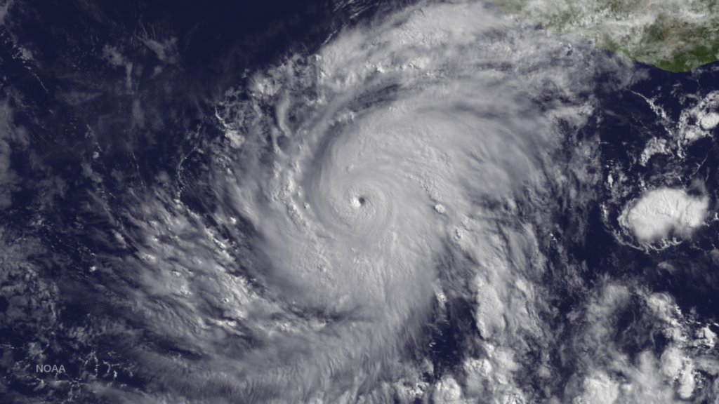
Hurricane Blanca Strengthens in Eastern Pacific, Winds to 130 MPH
Blanca has rapidly intensified with an increase in wind speed of 60 knots since 1200Z on June 2. The hurricane has developed a distinct pinhole eye in visible images surrounded by very deep convection. There is an opportunity for Blanca to intensify further since the hurricane is located within an ideal environment of low shear and high ocean heat content. Beyond 48 hours, the hurricane will encounter lower SSTs and a gradual weakening should begin. During the next 24 hours, the hurricane should begin a northwestward track with some increase in forward speed becoming a potential threat to Baja California in a few days. This image was taken by GOES East at 1445Z on June 3, 2015.
This entry was posted in Weather Articles and tagged 2015 Pacific Hurricanes, eastern pacific, Hurricane, hurricanes, pacific hurricane. Bookmark the permalink.
Read More
Ohio Valley Severe Thunderstorms: Damaging Wind and Tornado Threat From Kentucky to North Alabama, August 1, 2026
Ohio Valley severe thunderstorms are the primary concern for August 1, 2026, as the NOAA Storm Prediction Center has issued a Slight Risk outlook across parts of the Ohio and Tennessee Valleys. The risk corridor starts…
Extremely Critical Fire Weather Forecast for the Columbia Basin, August 1, 2026
Extremely critical fire weather risk areas for Saturday, August 1, 2026. Elevated in orange, Critical in red, Extremely Critical in magenta. Source: NOAA Storm Prediction Center Day 2 Fire Weather Outlook, mapped by iAlert.com. Extremely critical…
Ozarks Severe Thunderstorms: Slight Risk of Damaging Wind and Hail July 31, 2026
Ozarks severe thunderstorms are the headline hazard for July 31, 2026, as the NOAA Storm Prediction Center has issued a Slight Risk covering parts of the Ozarks and mid Mississippi Valley, with damaging wind gusts and…




